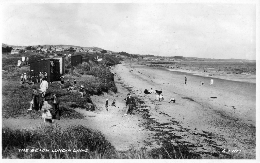
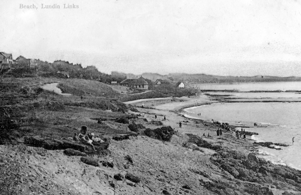
The huts were handily located above the shoreline and just a short stroll across the golf links to the train station. In the above image it looks like some of the beach goers are heading back up the sandy path to make the journey home. Do you recall beach huts at Lundin Links or know when they first appeared or finally disappeared? If so, please comment.
|
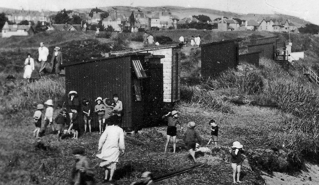
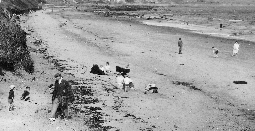
This circa 1940 scene on the beach at Lundin Links shows the popularity of the place at that time. The beach is lined with many bathing huts (see in more detail below). The 1940-41 Valuation Roll lists no fewer than 27 bathing huts on this site. Owners included the proprietors of some of the village's boarding houses, as well as other residents of Lundin Links, Upper Largo, Leven, Methil, Buckhaven and further afield including Edinburgh. The Children's Home at Aithernie, run by Margaret Paxton also had a hut, which was no doubt well-used by the young residents of this establishment.
The huts were handily located above the shoreline and just a short stroll across the golf links to the train station. In the above image it looks like some of the beach goers are heading back up the sandy path to make the journey home. Do you recall beach huts at Lundin Links or know when they first appeared or finally disappeared? If so, please comment.
0 Comments
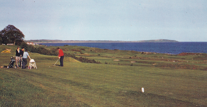
A bright and sunny day for golf at Lundin Golf Club, taken in the 1980s. This view highlights the course's panoramic views across Largo Bay. This image is looking east towards Elie direction. Do you have any vintage photographs of players on the course? Or perhaps of the Ladies course? If so we'd love to see them!
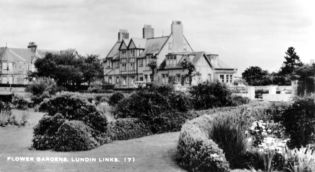
A circa 1960s view of the 'Flower Gardens' at Lundin Links, also known as 'Mrs Nisbet's Garden'. Peacehaven, the one-time boarding house, now a nursing home, is prominent in the background.
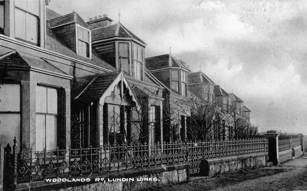
The above postcard image is very specific in its subject matter - focussing on just a small section of Woodlands Road. The date of the photograph is unknown but pre-dates pavements and a proper road surface. The ornate railings are a striking features of these houses at the east end of the street. Known as 'back braes' but locals around the turn of the century, this street was a well-worn path to get down to the harbour area at Lower Largo.
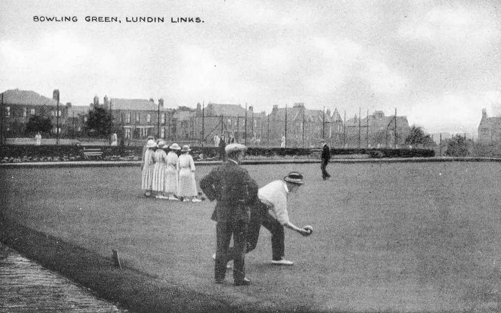
This charming view of bowlers in action on the green at Lundin Links is undated but gives an idea of how the bowling green and neighbouring tennis courts must have been a hive of activity during the busy summer seasons in Lundin Links during the early twentieth century. Officially opened in 1905, the bowling club continues to thrive today.
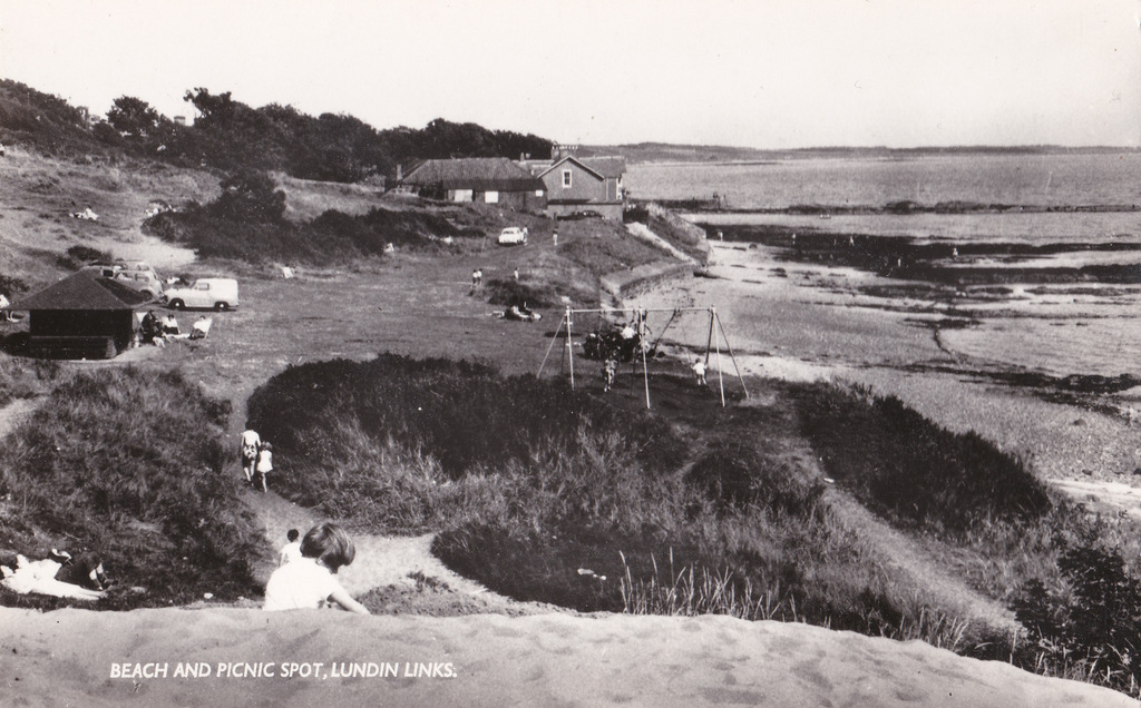
Above are couple of views across Massney Braes looking east - images separated in time by about 60 years. The top postcard dates to around 1905 and shows a rugged coastal area where the natural features provided the fun. Below that is a modern view of a more managed area, complete with shelter, swings and access for vehicles. The braes had been planted with marram grass by the time of the second photograph, in order to stabilise the sand and avoid erosion.
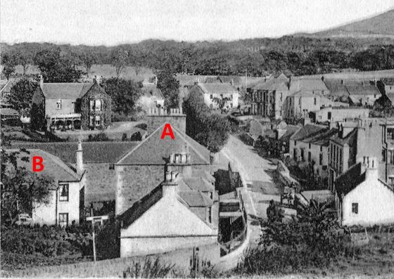
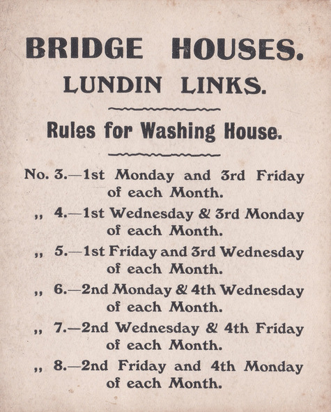
The 'Bridge Houses' in Lundin Links sit behind 'Bridge House' on Largo Road in the dip, on the south side of the Keil Burn. While 'Bridge House' (marked A above) on the main road was numbered 1 and 2 and contained shops for many a decade, the building behind (marked B) was numbered 3-8 and was residential. The latter shared a washing house in the early days of its existence and below is a scan of an original printed rota provided to the residents of the building. This tells them exactly on which days of the month they are permitted to use the washing house. Presumably on the days not mentioned on the rota, the owner of the buildings or other neighbours had the use of the facility. This type of rota would not have been unusual. In the 2010 book "Soor Plooms and Sair Knees" by Bob Dewar, the comment made about washing day is that "use of the out-door communal wash house and mangle was designated by an inflexible rota. Washing accoutrements included wellies, rubber apron and a large wooden stick for lifting clothes in and out and stirring tangled garments. The boiler was heated by a coal (what else?) fire underneath." The rota at Bridge Houses seems similarly inflexible.
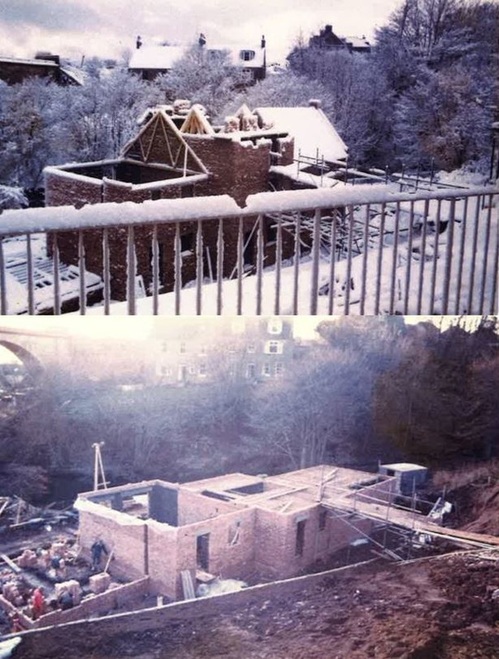
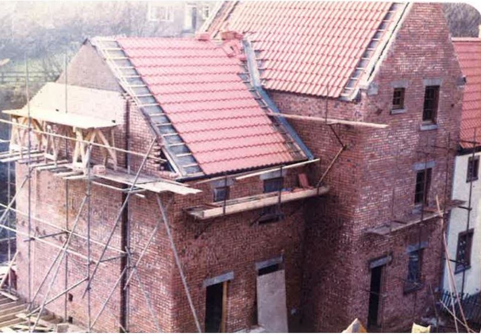
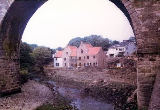
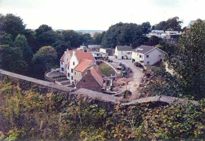
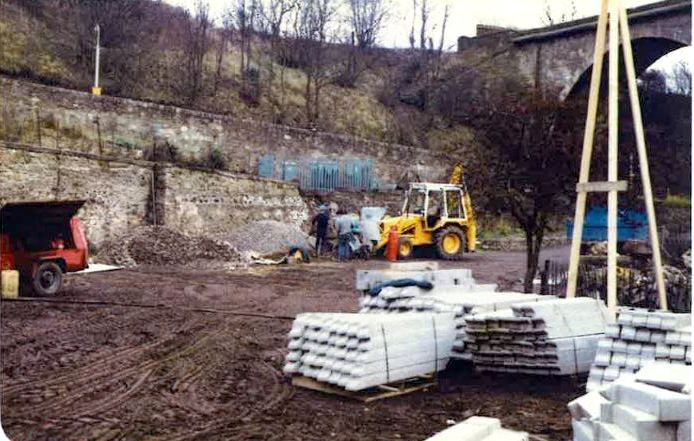
By the winter of 1983-84, the new development of Seatoun Place was really getting off the ground. The development was carried out by the owners of the former caravan site, Robert and Catherine Band, and built by Robert Band Ltd. Both of the images above show the viaduct at the top left and Burnbrae Terrace in the background. Below are photographs of the homes nearing completion. The first shows detail of the construction work, the second, the houses framed by an arch of the viaduct, while the third is an almost aerial view taken from the top of the viaduct. Last but not least, at the foot of this post, images of the former mill's edge running stones and base stone being put into position at the entrance to the development, as a reminder of the original use of the site. With thanks to John Band for the photographs.
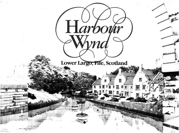
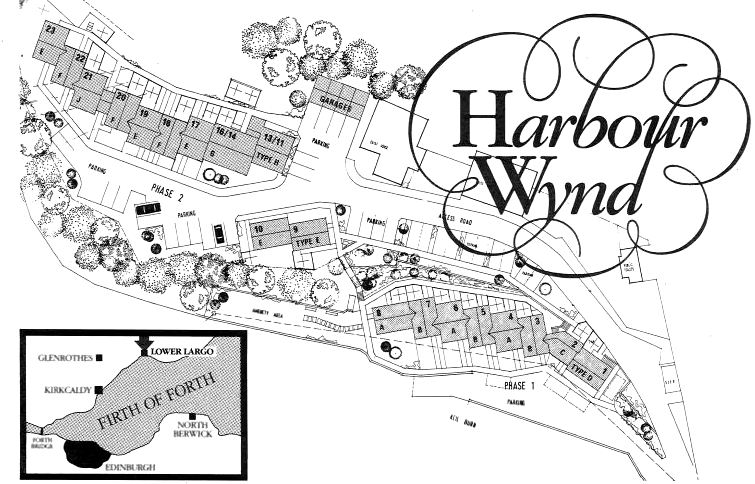
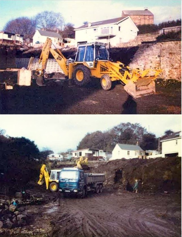
The dawn of a new era began in 1983 for the historic mill site by the viaduct at Lower Largo. The caravan site which had occupied the site for three decades had been cleared and now work began on a new housing development - named 'Harbour Wynd' in the marketing literature shown above but ultimately to be known as Seatoun Place. The photograph below shows the early stages of the development works. The marketing brochure plan (below) for the new development shows that there was originally to be a 'Phase 1' close to the viaduct and a 'Phase 2' set further back. However, only plots 1-8 ultimately came to fruition. With prices starting at £23,500 these beautifully situated dwellings would prove to be a great investment. Further below are two more images from the early building work, which exposed remains of the old mill. The former mill manager's house is seen in both images - the smaller white building with the grey roof. Tomorrow's post will feature the development in a more advanced stage of construction. With thanks to John Band for the images and information.
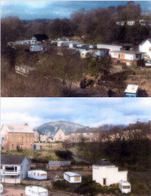
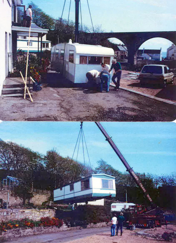
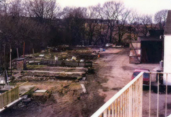
Previous posts have looked at the Lower Largo Caravan Site and the earlier uses of the site as a spinning mill and then an oil and cake mill. This post focuses on the final days of the caravan park, as the location prepared for another change of use. The images above show the site circa 1980, as seen from the viaduct. The top image features Robert Band's workshop and cottage on the right and the site's toilet block opposite the workshop. At the left is a stable block and just visible in the centre, at the foot of the photograph, is the excavated tunnel entrance, from which the dam would have been emptied in the days of the mill. The lower photograph above shows the old gas works retort house on the left and the public conveniences on the right. Below are pictures of the removal of the caravans in 1982 when the site finally closed. Firstly, a couple of shots of caravans being lifted on a bright sunny day and, below that, the area cleared and getting ready for the next phase of development - the building of Seatoun Place! More on that in the next post... With thanks to John Band for the photographs and information.
|
AboutThis blog is about the history of the villages of Lundin Links, Lower Largo and Upper Largo in Fife, Scotland. Comments and contributions from readers are very welcome!
SearchThere is no in-built search facility on this site. To search for content, go to Google and type your search words followed by "lundin weebly". Categories
All
Archives
July 2024
|

 RSS Feed
