VINTAGE LUNDIN LINKS AND LARGO
  • Blog

More about Drummochie Harbour

27/8/2021

0 Comments

 
Picture
Picture

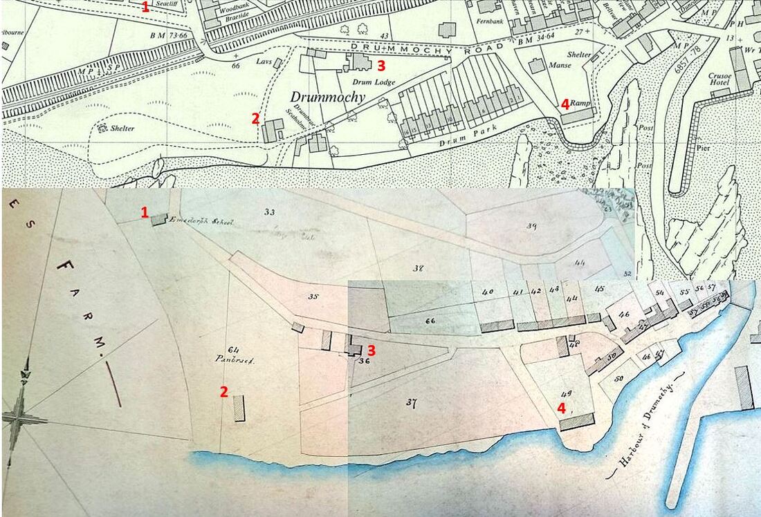
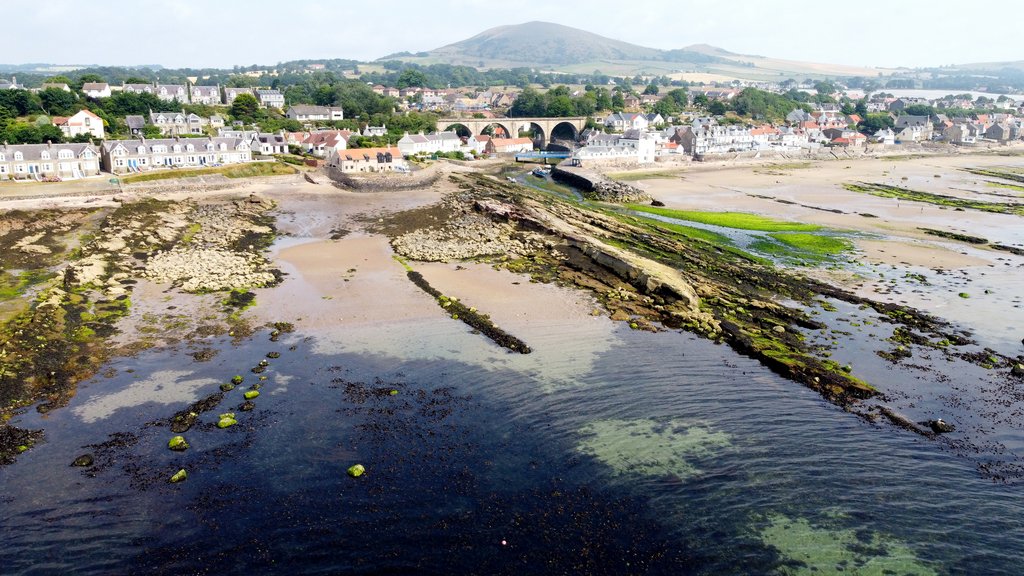
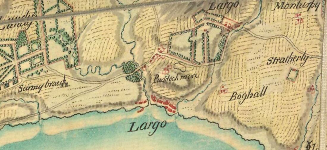
As a follow-on from the previous post about the Port of Drummochie, and the heyday of the salt pans there, we can look in more detail at the visible evidence of the old structures around this area. First, for context, a map comparison (above) of Drummochy in 1964 (top) and a feuing plan of the same area from around 1840. Numbered on both maps are:

1. The site of the former Emsdorf School;
2. The Salt Panhouse on the 'Panbraes';
3. Drum Lodge;
4. Salt Girnel (later known as Net House).

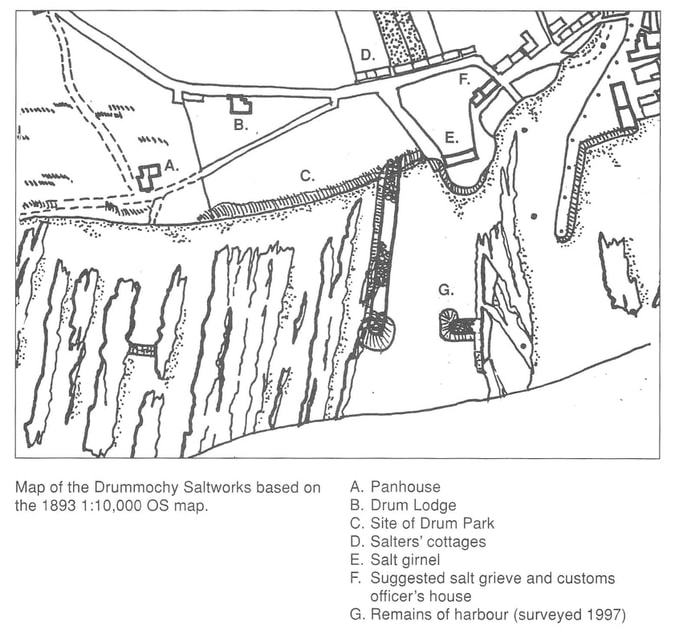
These landmarks and others are also annotated on the map below of Drummochy Salt Works from the book 'Largo - An Illustrated History' by Eric Eunson and John Band. This also shows how the pair of skerries of rock directly in front of the panhouse would likely have been dammed to create a 'bucket pot' (basin). Here the sea water would have been held when the tide was out, ready to be drawn up into the panhouse for boiling. More about the salt production process can be read about here.

Picture
Picture
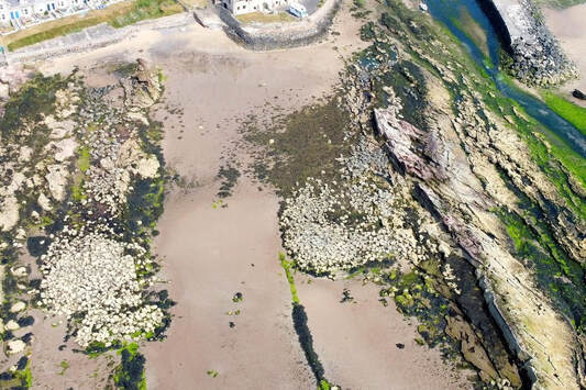
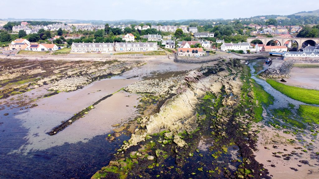
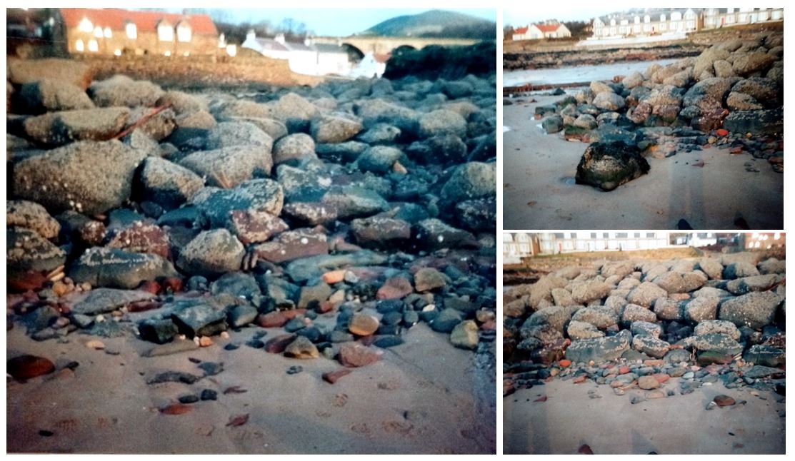
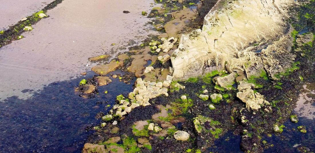
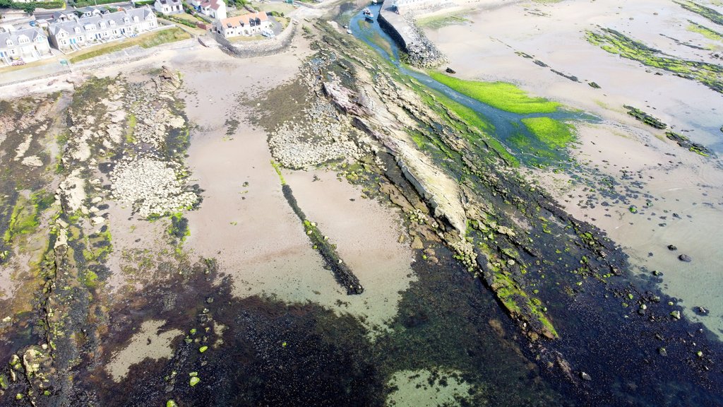
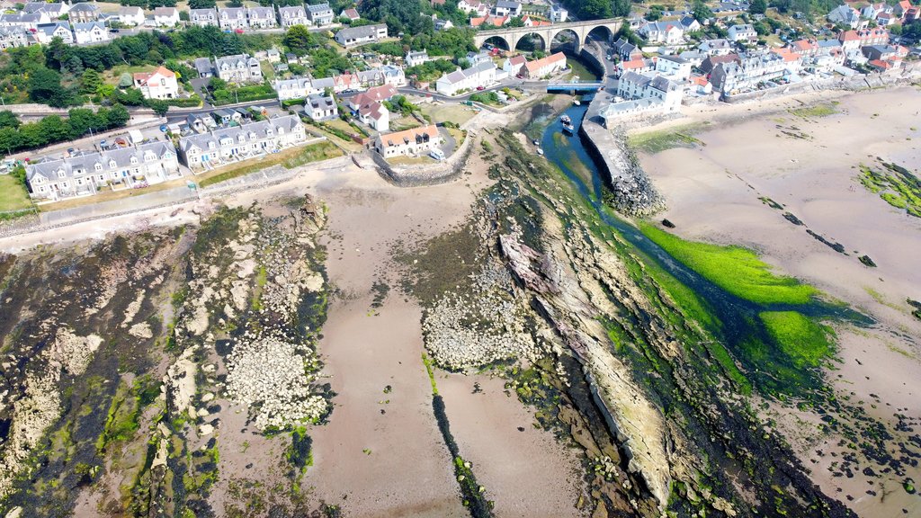
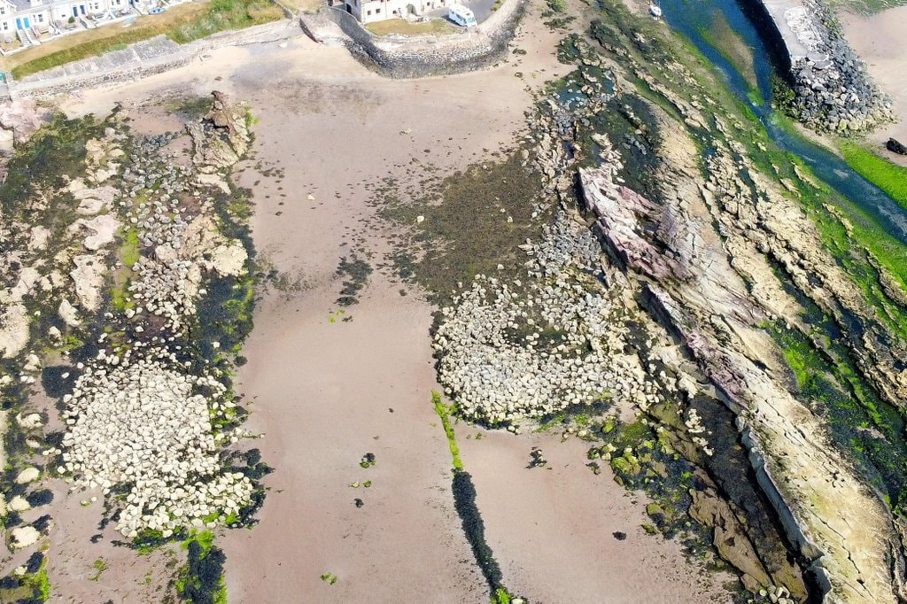
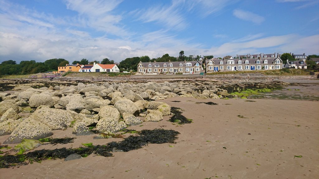
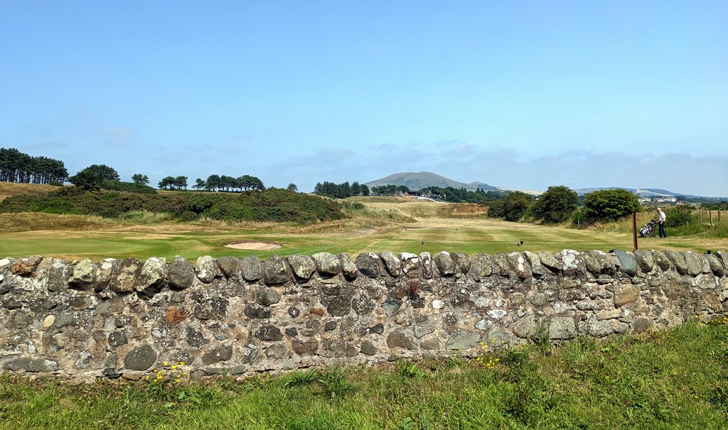
The aerial image above and the ground level images below show the remains of the harbour structure. Much of the original stone would have been recycled into new building works long ago.  The former 'Pan Braes' became known as 'Massney Braes'. Unable to find any definitive origin or meaning for the word Massney, I wonder if there is any connection to stone masons using this area as a source of material. Opinions welcome on this idea - or evidence of an alternative meaning to the name. It's certainly the case that stone has taken from this area of shore by masons. In 1880, legal action was taken to stop Thomas Tivendale, mason, from "taking stone for building purposes from the seashore opposite Mr Macrae's property". Mr Macrae was Colin George Macrae W.S. of Drum Lodge.
​
Picture
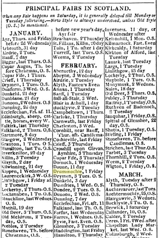
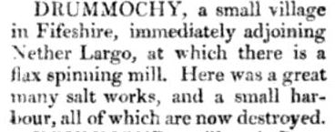
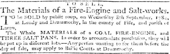
Interestingly, on the c1840 map above, the present-day harbour at Largo is labelled 'Harbour of Drumochy'. This suggests that once the old Port of Drummochy on the west side of the Keil went out of use, the name was transferred (temporarily) over to the neighbouring harbour (the Drummochy name being established and well-known). Drummochie had its own annual Fair - see below from the 1828 Edinburgh Almanac. This took place annually on 1st February and had been established sometime prior to the mid-1770s. It was a regular event for well over a century, providing an opportunity for trading and amusement.

Picture
Picture
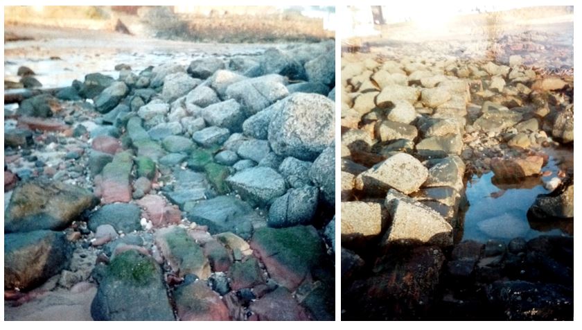
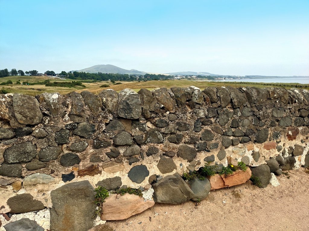
Above images show specific detail of the old harbour of Drummochie, captured at a time when there was less sand covering the area. The image on the left is the base of the sloping revetment of the harbour entrance (looking back towards Drum Park). The photo on the right is the end of the pier section which projects from the Lundie rocks.
Picture

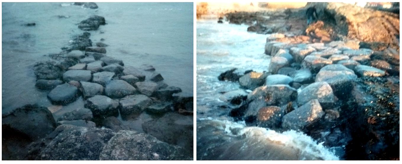
Another historic feature in this vicinity is the man-made extension to the end of the Lundie rocks. Built around the 1830s, in the pre-railway days of the steam boat services, this low-water pier allowed boats to dock, embark and disembark passengers and goods, whatever the state of the tide. The flat platform of cut rocks can still be seen at the Lundies southern tip. The two images above show this from the ground and below is the same area from above. Remnants of iron fixings in the rock indicate a walkway with a bannister once would have assisted passengers from the boat to the shore.

Enjoy a short drone video clip ending at the former Drummochy Harbour here: https://youtu.be/HzIW_B2jxbk

Picture
Picture
With thanks to John Band for the ground level images of the harbour remains and explanatory notes on these, also for permission to use the sketched map of the Drummochy Salt Works.
0 Comments

Port of Drummochie

20/8/2021

1 Comment

 
Picture

​The "Port of Drummochie" was once of greater importance than the harbour we now know as Largo Harbour. Located in the above aerial image to the left of the Lundie Rocks (the natural strata seen in front of the viaduct), the remnants of this former port or harbour can still be made out, at low tide, as distinct bands of rubble. The circa 1750 Roy Military Survey of Scotland map (below) clearly indicates the symbol for a harbour or port to the west side of the point where the Keil Burn flows into Largo Bay. It was here - on the Drummochy side of the burn - where three salt pans also once operated.

Picture

The advert below from 1 July 1771 Caledonian Mercury mentions the "port" right at the start of the description of the Lundin estate, emphasising its importance and later notes that there were "three salt pans adjacent". A similar advert from 1773 elaborates on the description of the harbour at Drummochie, stating that it "is of easy approach and can be made capable of receiving ships of considerable burden at moderate expense".
​
Picture
Picture

Drummochie or Drummochy has had several different spellings over time. It was made a free burgh of barony in 1540 and was then known as Drummoquhy, according to the above extract from the 'The Arms of the Baronial and Police Burghs of Scotland' (1903). Below is the 'Place Name Data' for Drummochy and further below is a piece from 1819 Topographical Dictionary of Scotland stating that, by then, the harbour at Drummochy (and salt works) had been "destroyed".

Picture
Picture

The demise of the harbour at Drummochy was linked with the end of the salt industry at the site. The 4 September 1784 Caledonian Mercury notice below shows that the three salt pans themselves were put up for sale along with coal fire engine. This sale (four decades after the start of the salt works at Drummochy) was overseen by Ebenezer Coutts, the bailie who lived at what is now Drum Lodge. The loss of the salt industry, plus the existence of the more natural Largo Harbour adjacent, must have meant there was no incentive to maintain the manmade harbour of Drummochy. 

Picture

Below are two more aerial images and a view from the ground of the remnants of Drummochy Harbour. Note the two significant areas of boulders, although no doubt many parts of the original harbour structure have long since been reused for other construction purposes. While it's great that some physical evidence of the old port remains today, it would be good to unearth more written information about the harbour in its working days. If you have any information about the former Drummochy Harbour, please comment.
​
Picture
Picture
Picture
1 Comment

Opening of Two New Golf Courses

13/8/2021

0 Comments

 
Picture

The previous post covered the 'Mile Dyke' wall that divides the golf links of Leven from those of Lundin. This post will look a little more at the events around the division of what was once a shared course. The photograph above, captured by John Patrick the Leven photographer, shows the former shared links. John Patrick returned to the scene on 29 November 1909 to visually record the opening of the new Leven course - going on to create a range of postcards days later, including of Major Shepherd driving the first ball (see advert below from the 1 December 1909 Leven Advertiser).
​
Picture

Described in the same edition of the Leven Advertiser as "the end of an auld sang", the course division prompted mixed feelings among golfers. Many felt sorrow as they played their last round on the shared links, others relished the thought of the new challenge. The origins of the change date back to a meeting of the Joint Green Committee (made up of members drawn from the Innerleven, Leven Thistle and Lundin clubs) held on 8 August 1907. The question of applying for a renewal of the leases of the links with Sir John Gilmour and Mr R.M. Christie of Durie was raised (the leases being up at Martinmas 1909). While the renewal was being considered, the issue of congestion in the summer months was repeatedly raised. A sub-committee was created to look at potential solutions. Several schemes were considered. Ultimately, Sir John decided that a complete eighteen hole course should be laid out on the Lundin side.

This initially caused some consternation among the Leven golfers and left them little alternative but to do the same on the west side of the Mile Dyke. Negotiations opened up with Mr Christie of Durie and with Mr Russell of Silverburn. Eventually, terms were agreed with both men. The football ground to the north of Leven's bowling green and the Ladies golf course was taken in, as was a stretch of Silverburn ground. A new site was found for the Ladies golf course. The sketch below from the 30 June 1909 Leven Advertiser illustrates the new Leven layout, as set out by clubmaker Alex Patrick.
​
Picture

Ground also had to be acquired on the Lundin side for the new full course there. Two fields from Sunnybraes Farm plus the Ladies golfing ground provided the necessary space. Champion golfer James Braid laid out the new Lundin Golf Course, an outline sketch of which is shown below. The Ladies were found a new location at the Standin' Stanes Park and an adjoining field. 
​
Picture
Picture

The day of the opening ceremonies of the two new courses (Monday 29 November 1909) saw brilliant sunshine after an early morning mist had lifted. In an opening address, Major Shepherd stated that they had "just parted with a very old and dear friend whose every feature and peculiarity they had through long association become intimately acquainted with; a friend in whose company most of them had spent perhaps the pleasantest hours of their leisure; a friend whose memory would remain with them so long as they lived". 

It was also acknowledged in the address that course congestion had been a nuisance, especially in the summer months, at both ends of the course. Often there would be a wait of an hour or an hour and a half at the halfway point. For the Leven event, both John Patrick and Miss Mayor "took some striking shap-shots in connection with the opening ceremony". The above photograph by Mayor shows: standing from left to right - Mr J. Ogilvy Shepherd, Mr James Henderson, Mr John Adamson, Councillor T.T. Greig, and seated from left to right - Councillor Aitken, Major Shepherd and Mr J.C. Rolland.

Meanwhile, on the Lundin side, the course was opened with a speech by Sir John Gilmour who presented a golf club to Captain Benjamin Connell Cox (resident of Largo House) with which to drive the first ball.  The couples that set off behind the Captain and Vice-Captain were as follows....
Picture
The list includes quite a few familiar names - such as John Adam, Sam Duncan (proprietor of the Lundin Links Hotel), Andrew Masterton, Andrew Peebles, Robert Paxton, Andrew Somerville, and Dr Eggeling. Photographs of the event was captured by Robert Paxton and Mr A Hutt. Many of those listed above appear in the photograph below. The men seated from left to right are: 

Mr R.C. Paxton (ex-Captain)
Sir John Gilmour 
Mr B.C. Cox (Captain)
Mr George Russell (Vice-Captain)
Reverend D. Macmichael

On the far right standing is John Adam. Further below is an image of Benjamin Cox driving off the first tee. The trophy at stake for the inaugural day's play was a silver cup presented to the club by Cox. It was won by George Russell, with a score of 91 less 9 - 82. After the competition, the players adjourned to the Lundin Links Hotel for lunch. Being a November weekday, many of the Edinburgh contingent of summer visitors were not present. However, they sent a collective telegram wishing the new course every success. Also absent was club stalwart Thomas Nicoll due to ill-health. All agree that it had been a red-letter day and that despite the sentimentality regarding the old course, better sport would be provided by the new one.

Picture
Picture
0 Comments

The Mile Dyke

6/8/2021

1 Comment

 
Picture

In recent times the 'Mile Dyke' has been known for being the dividing point between the course of the Lundin Golf Club to the east and the Leven Links Golf Course to the west. However, the wall or 'dyke' itself predates both courses, going back to the eighteenth century. The 'Miledyke Wood' appears on the 1854 O.S. map (see below). And, in the accompanying O.S. Name Book, the Miledyke Wood is described as "A wood chiefly composed of oak, beech and elm trees, planted nearly a century ago on the estate of Lundin". Historically the dyke was a march wall that formed the boundary between the estates of Lundin and Durie. 
​
Picture
Picture

​The Mile Dyke is similar in appearance to the wall at Fir Park in Lundin Links (shown below). Both are well-built random rubble masonry walls with large boulders arranged somewhat haphazardly at the base but topped with more uniform stones. Both are built from a mix of local stones (some likely gathered from the beach) set with slightly recessed mortar, so that all the stone faces can be easily seen.

Picture

Always a local landmark and notable point of reference, mentions of the Mile Dyke in the local newspapers often relate to property lost close to it - see examples below from the Leven Advertiser in the early 1900s. 
​
Picture

However, most frequently, the Mile Dyke is mentioned in relation to golf. Leven Links dates back to 1846 and originally ended to the east at the Mile Dyke. It was extended beyond the dyke by 1868, towards Lundin Mill. Lundin Golf Club was instituted at the same time. The Mile Dyke thus became not a golfing boundary but a hazard in the centre of the green. A shared Leven-Lundin golf links arrangement meant that play started at both ends with a pause at the half-way point to take turn about. However, by the early years of the 20th century, the increasing popularity of golf locally led to frequent congestion and drastic change was required. In 1909, new full eighteen-hole courses opened at each end and the golf links was divided. James Braid designed the Lundin course, while Alex Patrick laid out the new Leven course. When an end came to the previous combined arrangement, the Mile Dyke reverted to its role as a boundary point.
 
Picture
Picture

The Leven Mail ran a poem about the Mile Dyke on 16 October 1946, penned by James Dingwall of Leven. Shown in full below, the humorous words highlight the robustness and longevity of the wall. The piece ends with the fitting statement that the Mile Dyke "will for lang years yet be seen".

Picture
1 Comment

    About

    This blog is about the history of the villages of Lundin Links, Lower Largo and Upper Largo in Fife, Scotland. Comments and contributions from readers are very welcome!

    Search

    There is no in-built search facility on this site. To search for content, go to Google and type your search words followed by "lundin weebly".

    Contact

    Categories

    All
    Antiquities
    Beach
    Boarding Houses
    Business
    Churches
    Clubs And Societies
    Drummochy
    Facilities
    Farming
    Fishing
    Golf
    Houses
    Keil's Den
    Largo Law
    Lower Largo
    Masseney Braes
    New Gilston
    People
    Railway
    School
    Shops
    Standing Stanes
    Streets
    Tourism
    Upper Largo
    Viaduct
    War

    Archives

    March 2023
    February 2023
    January 2023
    December 2022
    November 2022
    October 2022
    September 2022
    August 2022
    July 2022
    June 2022
    May 2022
    April 2022
    March 2022
    February 2022
    January 2022
    December 2021
    November 2021
    October 2021
    September 2021
    August 2021
    July 2021
    June 2021
    May 2021
    April 2021
    March 2021
    February 2021
    January 2021
    December 2020
    November 2020
    October 2020
    September 2020
    August 2020
    July 2020
    June 2020
    May 2020
    April 2020
    March 2020
    February 2020
    January 2020
    December 2019
    November 2019
    October 2019
    September 2019
    August 2019
    July 2019
    June 2019
    May 2019
    April 2019
    March 2019
    February 2019
    January 2019
    December 2018
    November 2018
    October 2018
    September 2018
    August 2018
    July 2018
    June 2018
    May 2018
    April 2018
    March 2018
    February 2018
    January 2018
    December 2017
    November 2017
    October 2017
    September 2017
    August 2017
    July 2017
    June 2017
    May 2017
    April 2017
    March 2017
    February 2017
    January 2017
    December 2016
    November 2016
    October 2016
    September 2016
    August 2016
    July 2016
    June 2016
    May 2016
    April 2016
    March 2016
    February 2016
    January 2016
    December 2015
    November 2015
    October 2015
    September 2015
    August 2015
    July 2015
    June 2015
    May 2015
    April 2015
    March 2015
    February 2015
    January 2015
    December 2014
    November 2014
    October 2014
    September 2014
    August 2014
    July 2014
    June 2014
    May 2014
    April 2014
    March 2014
    February 2014
    January 2014
    December 2013
    November 2013
    October 2013

    Links

    Largo Baywatch Blog
    Fife Family History Society
    ​
    Polish Parachute Brigade Info​

    RSS Feed

Powered by Create your own unique website with customizable templates.