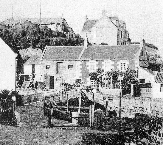
In the close-up below, the carts are lined up next to Bridgend House and its adjacent stables. This is where the Elder family ran a carting and cab hire business. The Belmont Temperance Hotel is clearly seen in its elevated position close to the station. The footbridge over the railway line is in the top left. In the foreground, a gate spans half of the path leading to the footbridge. At the time of this photograph, the Keil Burn could be crossed by railway, using the footbridge or by using the ford (which was marked out by old mooring posts and stone edgings). Today the road bridge offers the only easy crossing.
|
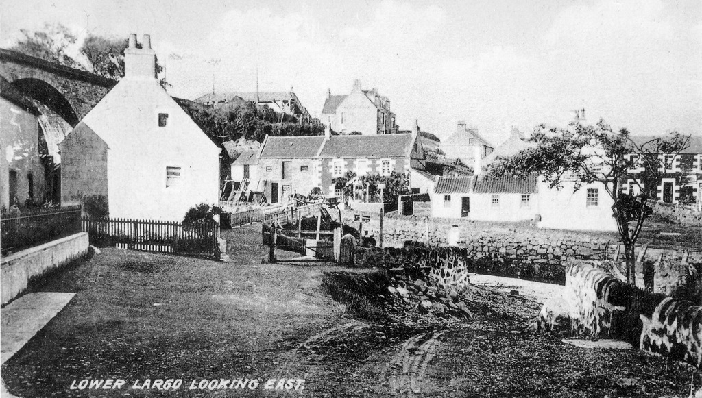
This c1900 photograph of Lower Largo Harbour area is taken from a pedestrian's perspective, so gives a wonderful impression of what it might have been like to walk from Drummochy, across the wooden footbridge, over to Harbour Wynd and perhaps onward up to Largo Station. The detail is excellent in this image, giving a feel for daily life at that time. Note the cart tracks in the dirt road, taking a turn down into the Keil Burn. Those using wheeled transport (before the 1914 opening of the harbour road bridge) would have to ford the burn, passing under the footbridge and the railway viaduct, before coming back up onto the road on the other side close to the heckle house of the old mill.
In the close-up below, the carts are lined up next to Bridgend House and its adjacent stables. This is where the Elder family ran a carting and cab hire business. The Belmont Temperance Hotel is clearly seen in its elevated position close to the station. The footbridge over the railway line is in the top left. In the foreground, a gate spans half of the path leading to the footbridge. At the time of this photograph, the Keil Burn could be crossed by railway, using the footbridge or by using the ford (which was marked out by old mooring posts and stone edgings). Today the road bridge offers the only easy crossing.
0 Comments
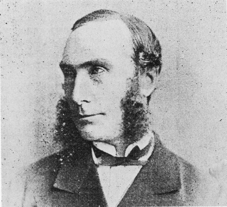
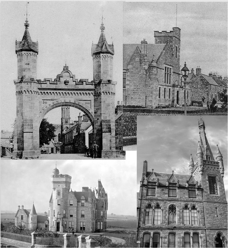
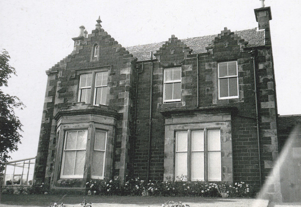
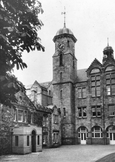
John Milne was born in Fettercairn in 1822. Son of a house carpenter, he was briefly apprenticed to his father before leaving his home area in the early 1840s to move to Edinburgh. He initially worked under John Henderson before he became clerk of works for eminent architect David Bryce, covering the St Andrews area. For the rest of his life he lived in St Andrews (mostly at 34 Argyle Street) and he designed many buildings both in the town and elsewhere in Fife (with occasional works back in his birthplace of Fettercairn). Soon after his arrival in Fife (early 1850s) he was adopted by the Free Church of Scotland and given a succession of commissions for churches and manses. Although his work in Lundin Links fails to get a mention in official lists of his work, this blog has established that he was architect for the 1858 Lundin Mill School and was part of the 'team' responsible for the Standard Life development of the village at that time. It is highly likely that he had a hand in other buildings erected around that time in the village. As James Campbell Walker was designing houses such as 'Bourtree Brae House' and 'Homelands', Milne might well have been responsible for other contemporary villas. It would seem likely that 'Haworth', neighbour to 'Homelands', off Leven Road could be the work on Milne. Looking at some of Milne's other works gives an insight to his style. Below are images of some of his best known buildings, namely (clockwise from top left) Fettercairn Arch (1863), Fettercairn Public Hall (1891), Duncan Institute Cupar (1869), and Westerlee St Andrews (1865). The Dictionary of Scottish Architects describes Milne as "a very competent Gothic designer", "geometrical" and "an inventive neo-Jacobean and Scots Baronial architect of the Bryce school". His mix of Flemish, Scottish and Gothic details often featured crowstepping, crucifixes, decorative plaques and turrets. He was known for having a different window style on each floor. Below is an image of 'Haworth' and underneath that one of St Leonard's College in St Andrews (one of his documented works). The book 'Building for a New Age' by John Frew contains a chapter about John Milne. Within this, it is noted that in the 1850s, while establishing himself in Fife, Milne undertook building and carpentry work on the buildings that he designed and that this flexibility helped him to gain commissions. He could well have been 'hands on' with several houses in Lundin Links, not just those he acted as architect on but also those designed by Walker. John Milne, who died in 1904 at the age of 82, was a keen churchman, a member of St Andrews town council for over 25 years, and Bailie for four years. He produced over sixty buildings and was heavily involved in municipal improvements such as tree planting, the laying out of gardens, drainage improvement, road widening and installation of proper pavements. Perhaps in the latter areas he would have had direct contact with Henry Petheram - long-time St Andrews area road surveyor - who lived in Lundin Links and moved into 'Haworth' soon after its completion.
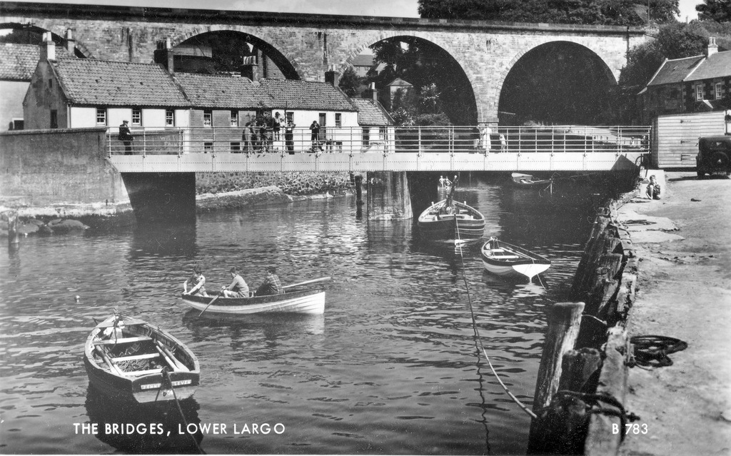
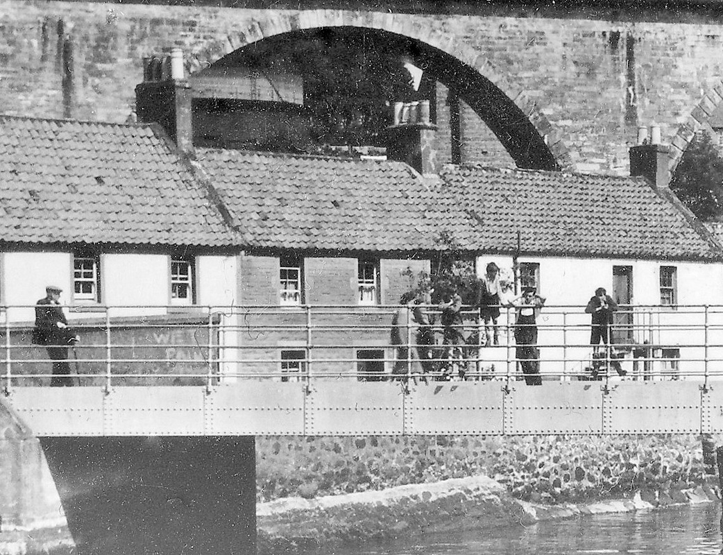
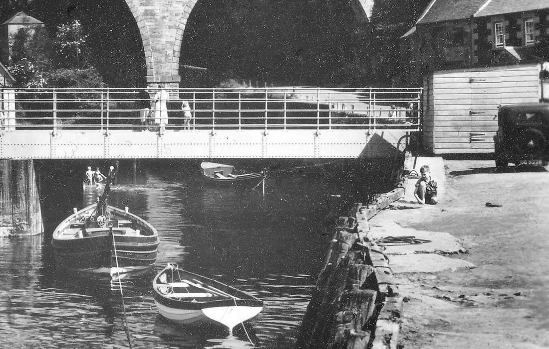
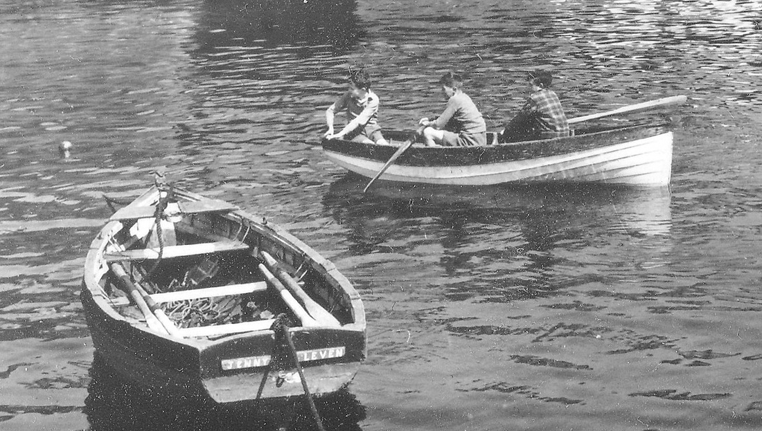
We've all seen images of Lower Largo Harbour similar to this one. However, this particular 1950s postcard is very clear and has lots of activity within it. Below are three different areas of detail. In the first, we can see the gas cylinder and part of the gas retort house through one of the viaduct's arches. A 'wet paint' sign can be seen on the wall adjacent to the road bridge. In the second image, note the public conveniences building through the left hand arch, three children splashing in the water under the road bridge and the detail of the pier in the foreground. The final image features three boys enjoying some rowing and another boat marked 'Jenny - Leven' in the foreground. Sadly, the sender of this particular postcard noted that the weather was "very showery and cool" during their July visit.
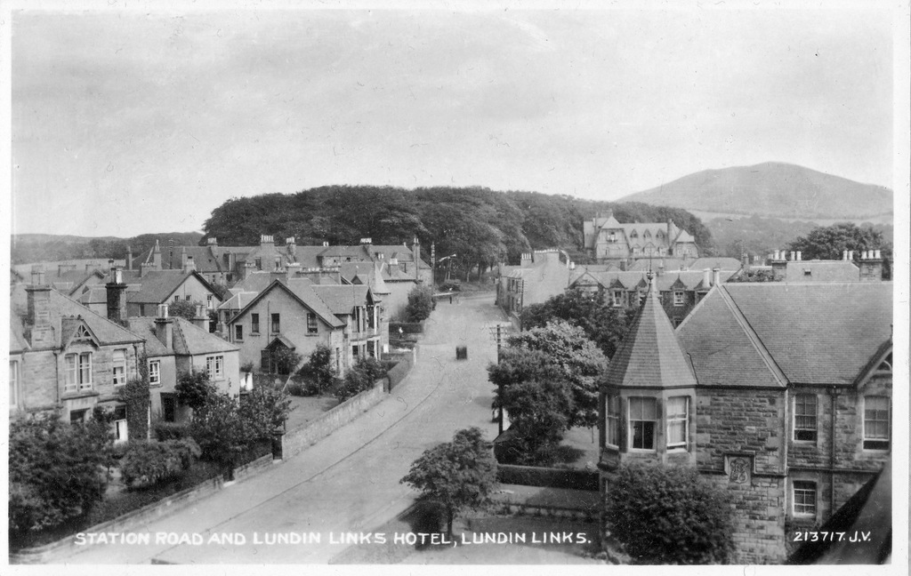
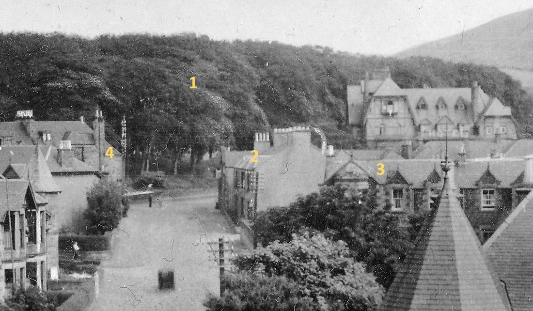
The above postcard might be named "Station Road and Lundin Links Hotel" but to me the most striking feature is the dense clump of trees once known as "Fir Park" (as over a century ago it comprised firs rather than the deciduous trees on the site today). Fir Park pre-dates any of the buildings in the image and in fact inspired the names of many of the buildings close to it. Annotated in the close-up image below we can see:
1. Fir Park itself 2. Park Terrace 3. Fir Park Cottages 4. Park View All of which suggests that the wooded area was once considered more of a 'park' - a green space, a pleasant view. The other noticeable feature of this c1930 image is all the huge telegraph posts in the streets. There is a particularly tall one next to the Post Office, where the telephone exchange was. Taken from the upper floor of what is now Peacehaven, this photograph must have been taken on a warm summer's day - nearly all the windows seen as open. Some years later, during the Second World War, an air raid shelter was constructed under Fir Park opposite the Post Office (long since sealed off). Posted in 1936, the sender of this postcard was unable to take to the water like the subjects of the image. She writes in late August of that year...
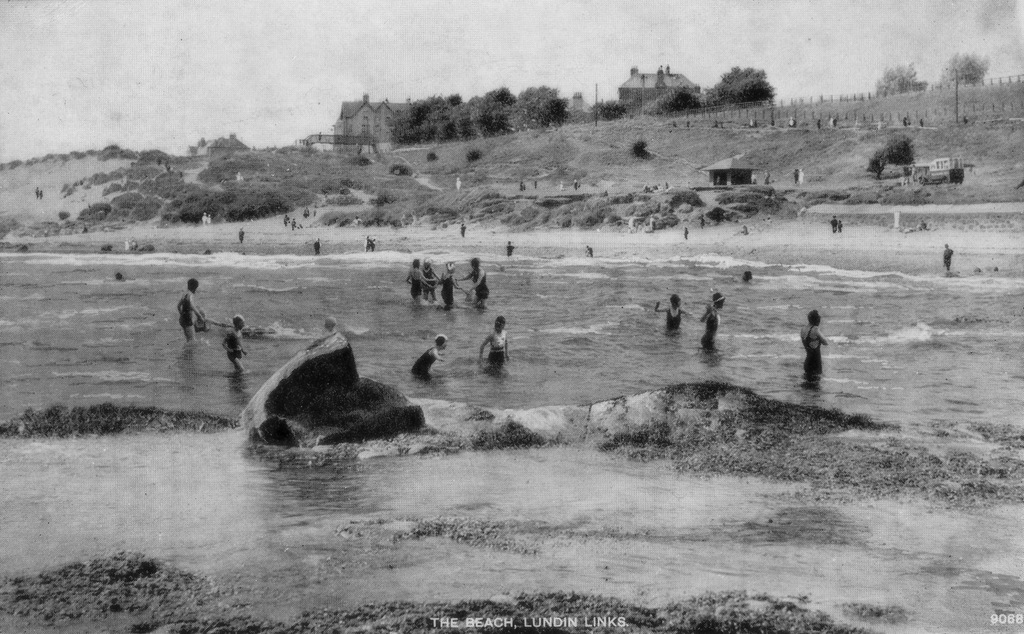
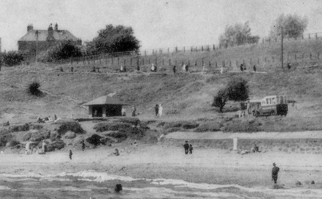
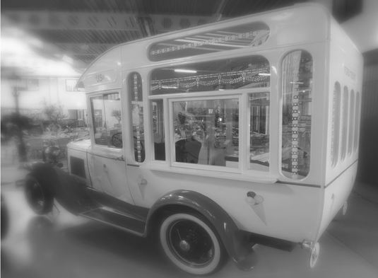
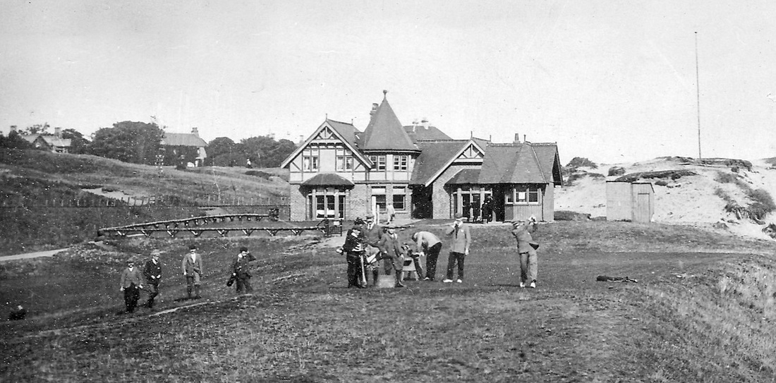
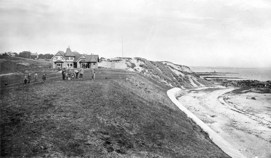
"Having a good holiday but very quiet. Have played some golf and tennis but no bathing. The weather has been very good but today looks a bit broken at the moment." Having a round or two of golf and doing a spot of sea-bathing were often the prime objectives of postcards writers holidaying in Lundin Links around that time. There are around 80 people enjoying the beach area on the day shown above! The Victoria Boarding House is visible left of centre in the background with the iron bridge over the railway line in front of it. The house to the right of centre is Norvil. The detail below shows a wooden shelter and an ice-cream van (similar to the one shown at the foot of this post) on the Massney Braes, as well as many people walking the footpath that ran parallel to the railway line. A group of about ten men are setting off for a round of golf at Lundin Golf Club, perhaps not all of them actually playing, some may be acting as caddies. One of them has been caught on camera mid-swing, while another rummages in his golf bag. There are several other people in the background next to the club house, which is looking fairly fresh and new. The photograph probably dates to between 1900 and 1910. The starter's hut is behind the man teeing off. To the left in the background are Oldfield (formerly Bayview Cottage) and Glenairlie (formerly Murree Lodge) on Crescent Road.
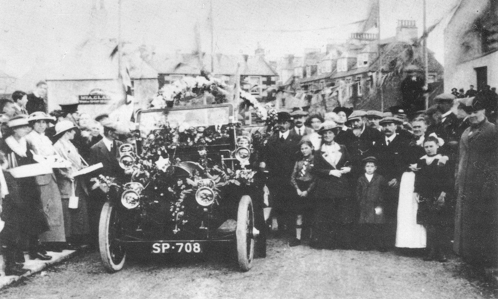
The opening of the Largo Harbour Bridge has been covered here before. However, this photograph is so good that the topic needs to be revisited. Taken on 3 October 1914, only a matter of weeks into World War One, the image features ladies on the left selling flags for charity. Belgian refugees were an early focus of wartime fund-raising and these ladies were probably collecting for this cause. Indeed a group of refugees from Belgium arrived in Kirkcaldy only days later.
The decorated car, registration SP 708, belonged to local builder Walter Horne. This was the first car to cross the new bridge after the cutting of a red, white and blue ribbon with a pair of silver scissors. Flags and bunting can be seen hanging around the bridge. The buildings in the background from left to right are The Railway Inn (light-coloured gable end), Alexandra House (centre), Edina View (3-storey terrace with former windows and many chimneys) and the Crusoe Hotel (extreme right). (Source: Kirkcaldy Museum and Art Gallery) The 'Largo Village Book' states that Girl Guides began in 1920 in Largo. This was ten years after the Girl Guides movement first began. In 1918, the Kirkcaldy Girl Guides had "delighted in the peace and ozone at Viewforth, east of The Temple - a finely situated, commodious villa on the edge of Dumbarnie Links, a stone throw from the sands." It was noted that "Alongside is a roomy marquee but what first attracted attention was the merry jingle of a portable piano and the chorus of happy voices chanting to the tune of "John Peel"." (Fifeshire Advertiser, 27 July 1918). Part of the visit saw the girls put on an exhibition at the Eagle Gates of Largo House, covering the history of humankind and raising funds for the Red Cross. No doubt this event helped encourage the creation of the Largo Guides soon afterwards.
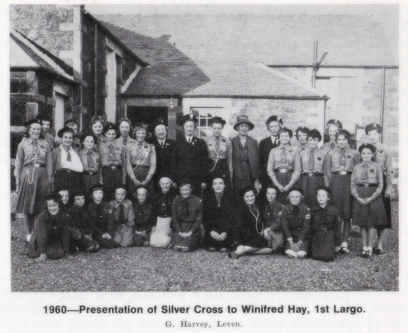
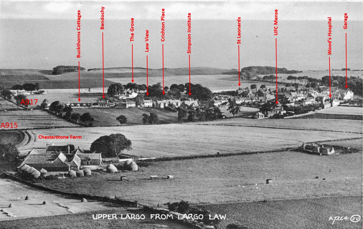
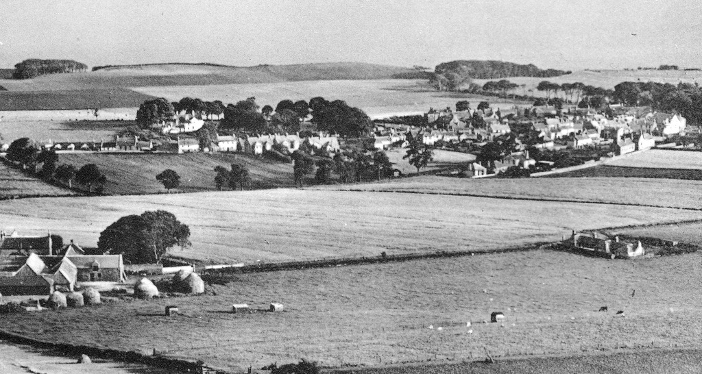
Early leaders at Largo were Miss F Cox of Largo House, Miss Margaret Paxton of Homelands and Miss Anne Turbayne. Brownies started in 1923 with Miss Nanny Cameron as Brown Owl and Miss Isabel Paxton as Tawny Owl. Rangers followed in 1924. When the 'Largo Village Book' was written in 1932, there were 22 Guides, 24 Brownies and 15 Rangers. The above photograph from 1960 shows the organisation continuing to flourish. Pictured outside the Durham Hall in Lower Largo, this occasion was the presentation of the Silver Cross for gallantry to Winifred Hay, who had saved a man from drowning in Largo Bay (source: 'A Kingdom for The Trefoil - Girl Guides in Fife 1910-1977' by Doris Coyne). Do you recognise anyone in the above photograph? Do you have memories or photographs of Largo Guides, Brownies or Rangers? If so, please comment or select 'contact'. Most of Upper Largo is visible in the above view taken from Largo Law, although North Feus is cut off to the right, as is Church Place. Also absent are the more recent additions of Woodlaw Park and Aithernie Drive. In the foreground is Chesterstone Farm on the left and its associated cottages to the right. Neighbouring Buckthorns Farm lies just off to the left in the distance - some of its cottages are marked further along the A917.
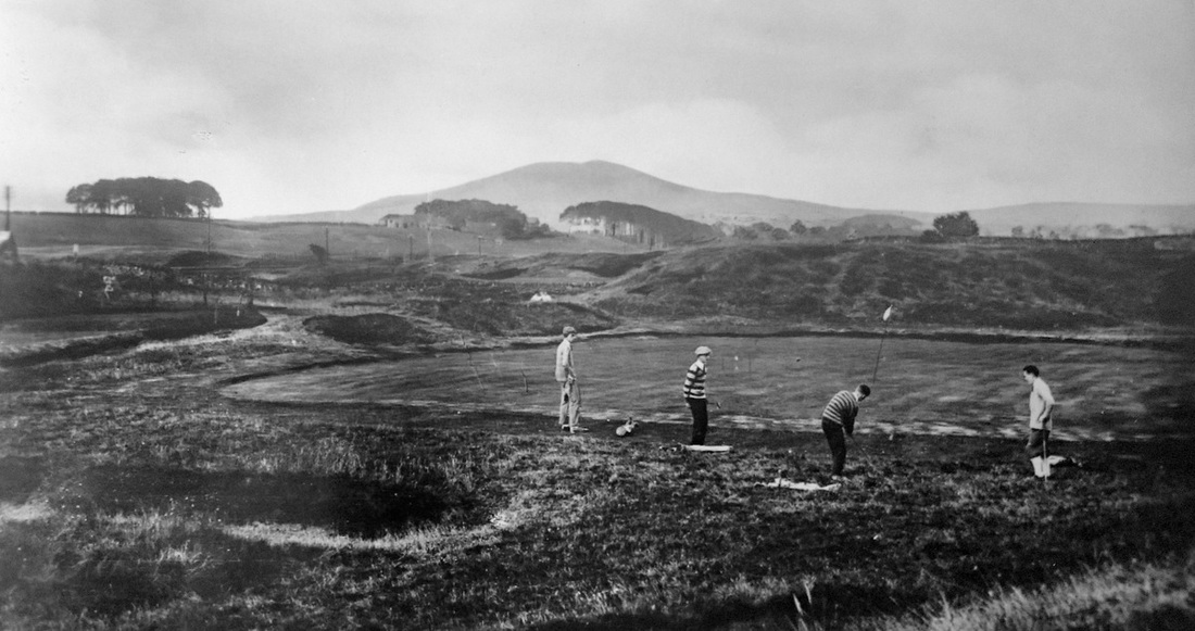
The significant cluster of trees in the centre of the image directly behind the row of buildings along the A917 is known as The Grove. Before the house of the same name was built there c1914 for Evelyn Baxter, this area was a bleaching green. It had a well which was utilised in the watering of the linen that was bleached there. The Simpson Institute is central to the image. Built in 1891, the Institute has tennis courts and a bowling green within its grounds. Next to it is Crichton Place, the short terrace of eight flats, which once had a curling pond to the rear. St Leonards, the house once home to Dr Palm and then to Dr Eggeling can be seen at the corner of South Feus. To the right of this, the tree-lined Serpentine Walk can be seen snaking into the distance towards Lower Largo. The garage on Main Street can be seen with its distinctive peak. Originally the Free Church, the associated manse is also marked. Between the garage and old manse is Wood's Hospital (now known as John Wood's Houses) which has origins going back 350 years. Below is the same view without annotations. The above image shows golfers at the 5th hole on Leven Links probably in the early years of the twentieth century. In the background are the buildings of Sunnybraes Farm - the first buildings seen when approaching Lundin Links from Leven.
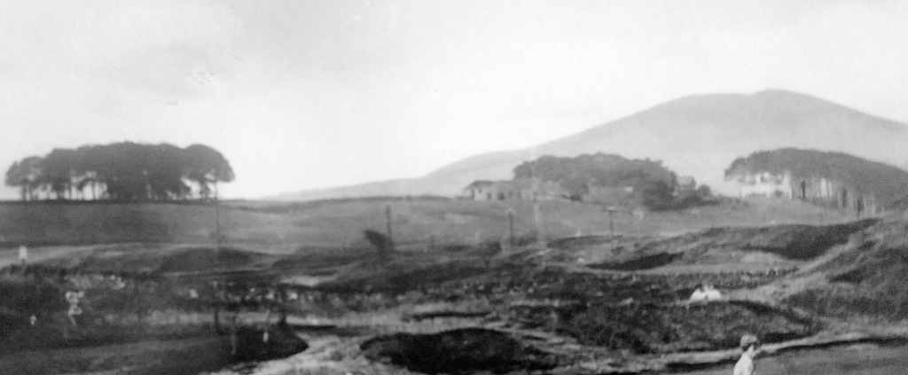
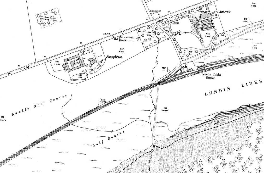
There are three distinct clumps of trees in the image (see map below from c1912): one in the middle of the field on the far side of the main road (long since removed), one between Sunnybraes and Aithernie (since largely built upon) and one running down the slope from Aithernie (now the Old Manor Hotel) towards the railway station (these trees are also mostly gone and modern housing has been built in the area). The railway line and telephone posts can be seen running between the Leven Links and the land that was part of Sunnybraes Farm but became part of the Lundin Golf Course. Note the roughness of the golf course, aside from the green itself. The flag seems to be on a bamboo cane. The map below gives more detail of the area, including the presence of a 'sheep fold' at the corner of the Leven Road and Pilmuir Road. |
AboutThis blog is about the history of the villages of Lundin Links, Lower Largo and Upper Largo in Fife, Scotland. Comments and contributions from readers are very welcome!
SearchThere is no in-built search facility on this site. To search for content, go to Google and type your search words followed by "lundin weebly". Categories
All
Archives
July 2024
|
 RSS Feed
