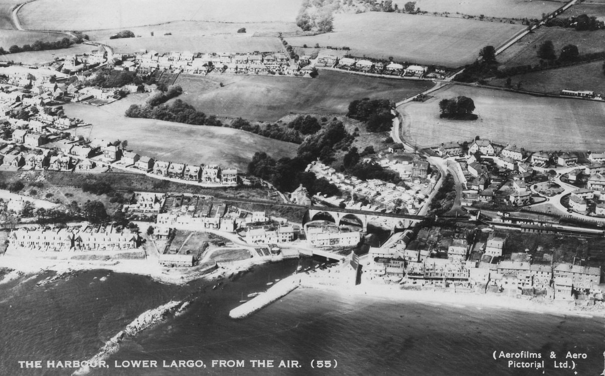
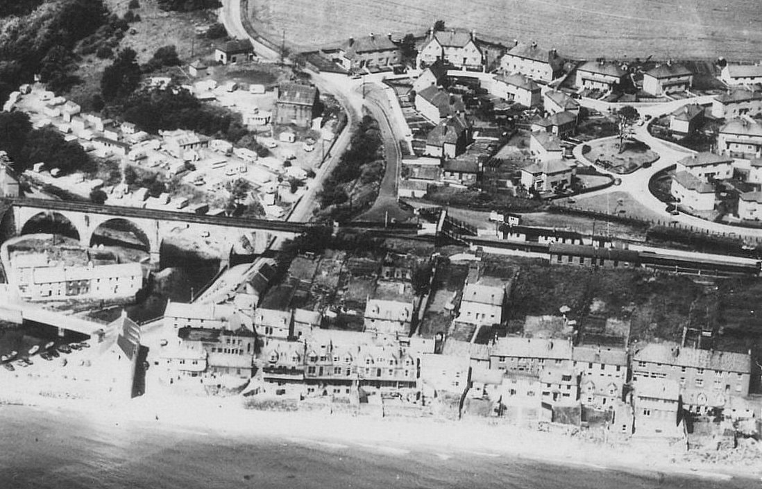
This circa 1965 aerial photograph is a familiar scene albeit with much more open undeveloped space than today. In this blog we will zoom in on a few features of interest and highlight some of the changes over the past six decades. Below is a more detailed view of the viaduct and Largo station with the caravan park and Station Park housing development behind. The first phase of council housing here was 22 homes in the late 1930s. A later phase after the Second World War saw a further fifty houses added. At the time of the aerial photograph, the railway line was reaching the end of its active use but it was prior to the demolition of the station buildings.
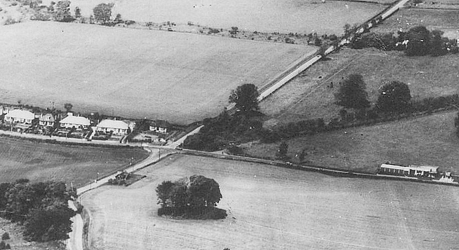
The disused Largo Toll House is also present in the image. In the detailed view below, the Toll House sits alone south of the war memorial cross road, close to a roundel of trees. It is those features that are remembered in the present day street names of Toll Court and The Roundel. The original Toll House was built in the 1840s and demolished in the late 1960s. More on this building to follow in the next post.
Among the other features of note below is the driveway up to Largo House, also known as rhododendron walk. and the garage/service station (the long roadside building on the far right) now known as Mercury Motors.
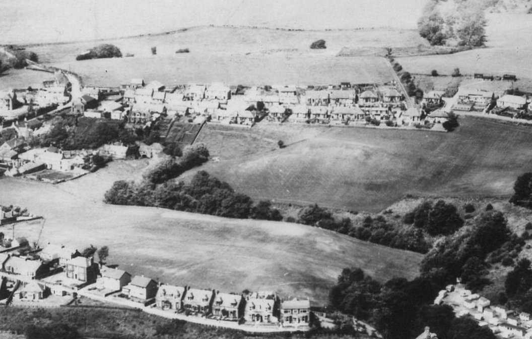
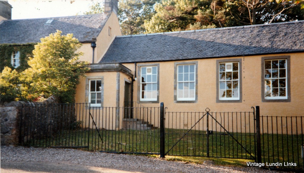
The final zoomed in area below is notable for the vast areas of undeveloped green space at the time. The field above the tree-lined burn is now filled by the houses of Keilburn, while the area below the trees is the site of Lundin Mill Primary School built 1973-74 to replace the Crescent Road school built in the late 1850s.
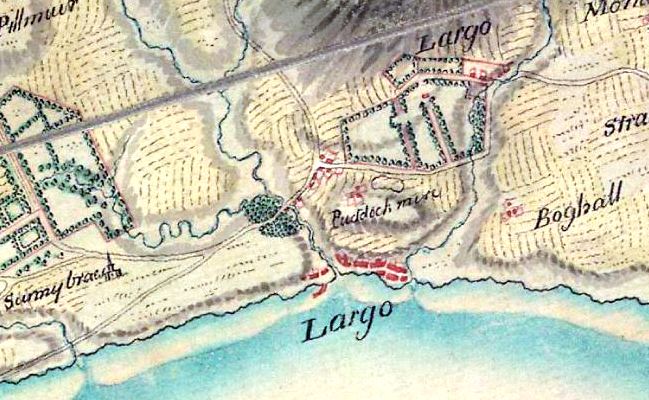
This space was once known as Puddock Mire - see extract from the 1750 Roy map. Puddock means toad or frog and Mire refers to boggy ground. A swathe of green space remains today on either side of the Keil Burn. The steps up to Largo Road from the mill can just about be made out, just left of centre above the tree line. Finally, the line of trees in the top right quarter of the image below marks the track leading to the one-time local landfill site, which closed in the 1970s.
This aerial view was captured by Aerofilms and Aero Pictorial Ltd. This company was the result of the 1958 merger between Aerofilms Ltd (founded in 1919) and Aero Pictorial Ltd (founded 1934). The extensive archive of historical air photographs was bought by Royal Commission on the Ancient and Historical Monuments of Scotland (RCAHMS), English Heritage (EH), and the Royal Commission on the Ancient and Historical Monuments of Wales (RCAHMW) in 2007. The subsequent Britain from Above project conserved 95,000 of the oldest and most valuable photographs in the collection, those dating from 1919 to 1953. Those images were scanned into digital format and made available on this website.

 RSS Feed
