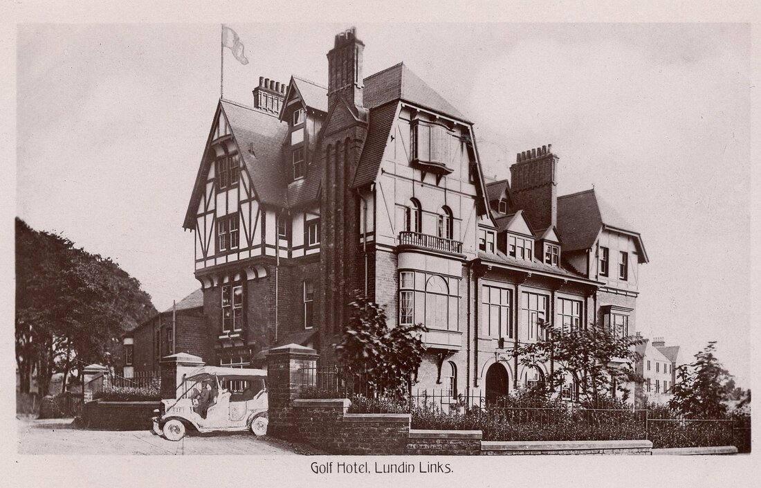
Imagine the scenario - you've just built a fashionable new hotel featuring all mod cons and had some professional promotional photographs of the hotel taken. However an important feature is missing from those images. It's the beginning of the 1900s and motor car ownership is dramatically increasing. Your target audience of well-to-do golfers would want to be sure that your hotel can accommodate their new or future vehicle. Thankfully, there is a solution in the form of photograph manipulation.
This was not a new phenomenon. The origins of photography can be traced back to 1822 and the editing of photographs developed gradually alongside the evolution of photography itself. The first well-known example of photo manipulation dates to 1846. In that case Calvert Richard Jones, a colleague of the pioneering photographer William Henry Fox Talbot, took a photograph of five Capuchin monks on the roof of a building in Malta. While four of the monks were aesthetically grouped, the fifth one was awkwardly standing a few feet behind them. Jones painted over this figure on the negative using Indian ink. In a positive print, the place where the fifth monk stood simply became a white patch of sky.
As well as removing features from images, technicians began to edit and add features to photographs as well. By the turn of the century manuals had been written for photograph 'retouchers'. Using scalpels, inks, pencils and paints, the retouchers would work at special angled tables to carry out their painstaking work on negatives. Sometimes, as in the case of the Lundin Links Hotel photograph, an entirely new image would be inserted into the main photograph, having been suitably scaled, trimmed and positioned. In the case below, a motor car has been added - exiting the hotel gate onto the main road. Although the scale and positioning are convincing, the tone is not quite right. The pale shade of the car stands out against the darker background scene.
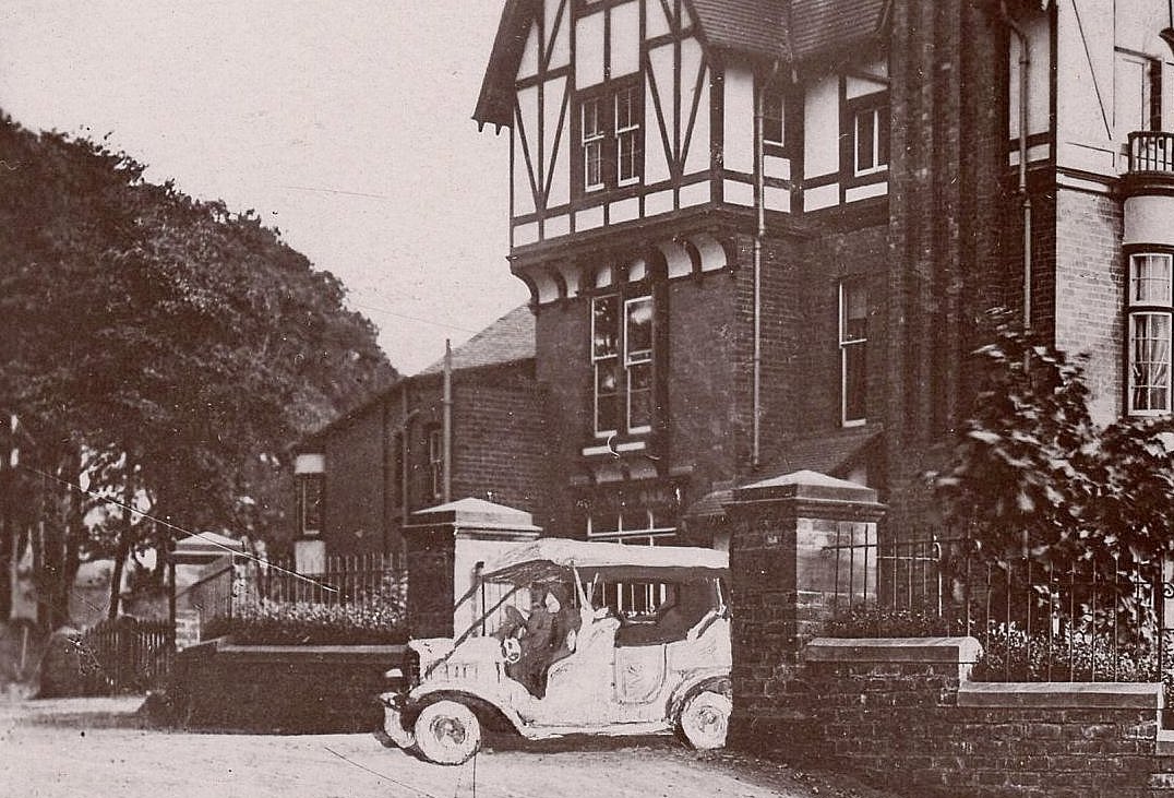
According to the National Motor Museum, at the end of 1895, it was estimated that there were only 14 or 15 cars on Britain's roads. This figure had risen to approximately 700 – 800 by 1900, the year that the Lundin Links Hotel opened. The car registrations system was introduced in the UK in 1903 and by 1910, there were approximately 12,000 licensed cars on UK roads. By around 1905 there was even motor car ownership within Largo, with Thomas Graham Wishart being an early adopter. By featuring a motor car on a postcard of the hotel, the proprietors were signalling that this was an innovative establishment, ready to cater for the needs of the modern guest.
Did you notice the other artificially added feature in the postcard above? A large flag was added to the roof for good measure. The hotel did have a flag pole (although not in the position shown here) and often flew a flag. However, when the postcard photograph was taken the flag was absent. The flag is less obviously image manipulation and is not a bad job considering that it was done some nine decades before photoshop.
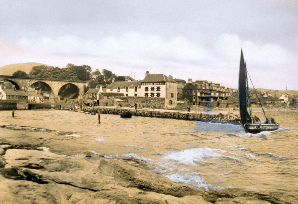
The hotel postcard is not the only example of photograph manipulation of Largo scenes. Below is a scene where the fishing boat KY 56 Fisher Lass. has been superimposed upon a more modern harbour scene. This earlier blog post explains how the same vessel appeared on various harbour scenes over the decades, as the appearance of the Crusoe Hotel altered. In the composite image below, Fisher Lass rounds the end of the pier circa 1910 but this detail has been overlaid on a 1930s background scene. The sky has also been touched up and the wave detail enhanced.

 RSS Feed
