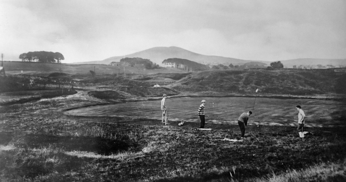
The above image shows golfers at the 5th hole on Leven Links probably in the early years of the twentieth century. In the background are the buildings of Sunnybraes Farm - the first buildings seen when approaching Lundin Links from Leven.
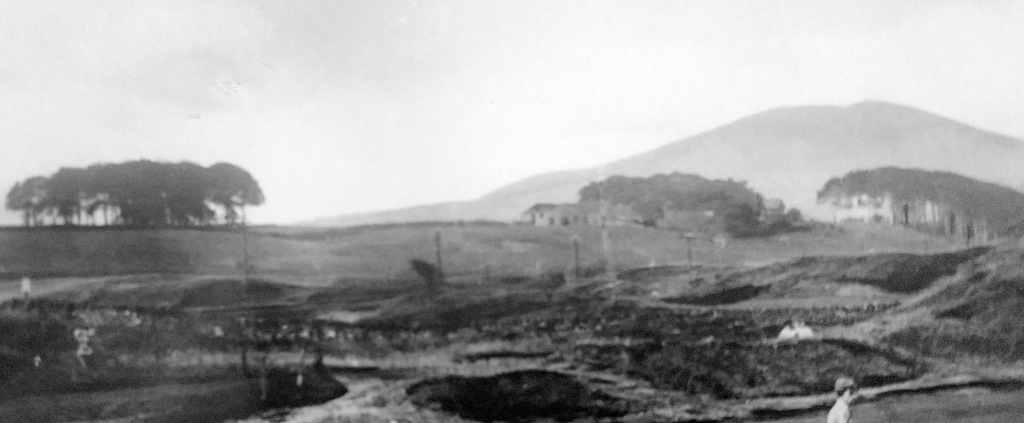
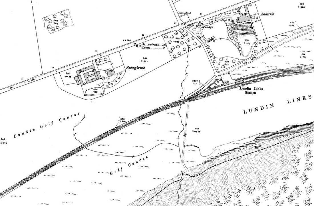
There are three distinct clumps of trees in the image (see map below from c1912): one in the middle of the field on the far side of the main road (long since removed), one between Sunnybraes and Aithernie (since largely built upon) and one running down the slope from Aithernie (now the Old Manor Hotel) towards the railway station (these trees are also mostly gone and modern housing has been built in the area).
The railway line and telephone posts can be seen running between the Leven Links and the land that was part of Sunnybraes Farm but became part of the Lundin Golf Course. Note the roughness of the golf course, aside from the green itself. The flag seems to be on a bamboo cane. The map below gives more detail of the area, including the presence of a 'sheep fold' at the corner of the Leven Road and Pilmuir Road.
 RSS Feed
