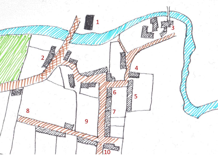
Many cottages at that time would have had thatched roofs. The generous sized gardens would have been well-stocked with vegetables and many might have kept livestock. The local grocer would have had meagre supplies compared to today's standards - including salt herrings, clay pipes, sacks of oatmeal and barley, candles, gingerbread biscuits and tobacco, for example. The map below shows the 1850 layout of the village, with some key features annotated.
6. Grocer's Shop 7. Weavers' Cottages 8. William Lindsay 9. Andrew Dall 10. James Methven
The White (or Whyte) family farmed Lundinmill for three generations. The farm had houses associated with it to the south of the Keil Burn ('2') in addition to the later Lundin Mill Farmhouse to the north. James White was both farmer of 96 acres here and the millmaster. At '4' are Dunkirk Cottages, which date to c1720 and at '5' was Paradise Place - a row of cottages demolished in the 1960s. The tall and substantial building at '6' contained a grocer shop while the adjacent five low-level cottages at '7' would have been occupied by weavers. At '8' in 'View Bay' cottage lived William Lindsay a Sea Captain. Within that same vicinity was Alexander Tivendale the mason and at '9' was another mason - Andrew Dall. The Methvens had the feu in the south east corner of the village ('10') which was next to the bleaching green - this family contained both weavers and stone masons.
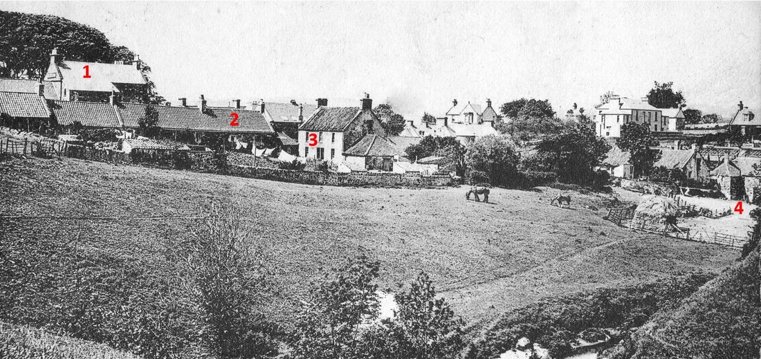
In the image below of Lundinmill (taken around the turn of the century) highlighted are 1. grocer's shop; 2. Paradise Place; 3. Dunkirk Cottages; 4. the mill. There is much of c1850 Lundinmill left to see today, although now all residential.


 RSS Feed
