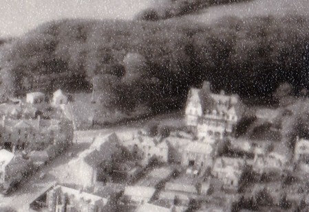
Focussing on another couple of details from the aerial photograph shown in the previous post, above is the Lundin Links Hotel with the main road curving behind it and the 'Fir Park' area of trees beyond that. The name is confusing due to the lack of any fir trees here within living memory. However, I recently saw a map dated from c1850 that clearly labelled the wood as 'Fir Park'. Possibly the fir trees were exploited for timber in the past and eventually the area was recolonised by other tree species. As if often the case, the old name lingered on for a while. The name was also given to one of the houses on Crescent Road in the mid-19th century (the one closest to the wood).
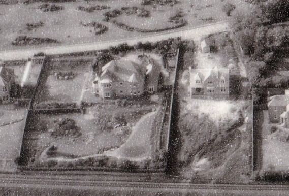
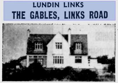
The house on the right of the above image caught my eye as it appears to be still under construction. Although fairly complete, the gardens are still uncultivated. It looks very much as if the site was until recently a gap site and possibly used as a shortcut down towards the golf course and the beach. The house was named 'The Gables' and can be seen again below when it was sold in 1979. The larger plot on the left above is 'Beffens' - built for Mrs Barbara Nisbet in 1923. It had a tennis court at the side of the house which Mrs Nisbet would on occasion open to the public for fund-raising events. The public garden to the top of the above image are still known as 'Mrs Nisbet's Garden'.
 RSS Feed
