|
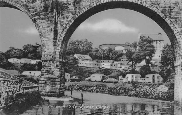
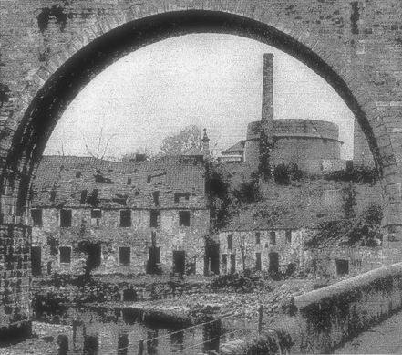
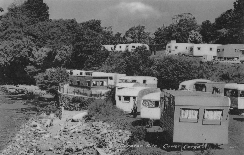
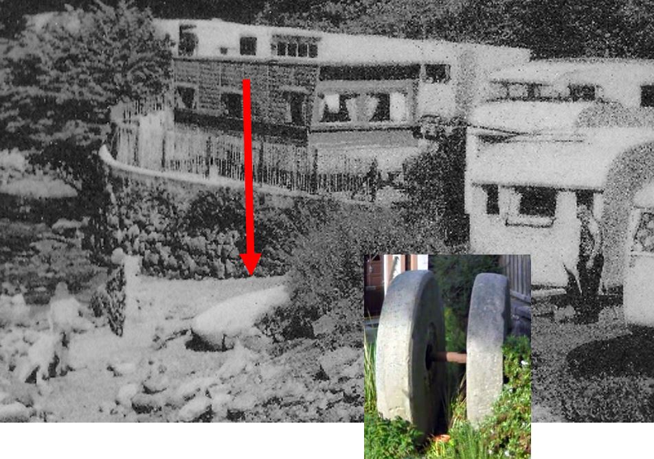
I have recently come across some different views of the old caravan park that was sited beneath the arches of the railway viaduct where Seatoun Place now stands. In the above image the gas holder and retort house of the former gas works can clearly be seen in the background. In fact, the presence of the gasometer and the rocky foreshore along the Keil Burn make this 1950s view not dissimilar to the 1938 view below of the ruined spinning mill which preceded the caravan park. The caravan park evolved over the years and a later image can be seen here. The unusual photograph below also shows the caravan park in its earlier days. This view shows the detail of the stony banks of the Keil. Could that be the old mill stone lying abandoned next to the grassy verge, just below the fence-topped wall? It is known to have been buried at one point, only to be dug up once more at a later date. It now takes pride of place by the entrance to Seatoun Place. It seems to be the correct size and shape to me! Let me know what you think...
1 Comment
Vintage Lundin Links
12/11/2015 05:06:28 am
Thanks to John Band for confirming that this image of the former caravan site does indeed show one of the former oil mill edge running stones. These, along with the base stone, were dragged from the rubble of the main millhouse by his father Robert Band circa 1953 using a Fordson Major tractor. The stones were dug up when the family built the lower section of Seatoun Place in 1982 and were sited at the entrance to the development, where they remain today.
Reply
Your comment will be posted after it is approved.
Leave a Reply. |
AboutThis blog is about the history of the villages of Lundin Links, Lower Largo and Upper Largo in Fife, Scotland. Comments and contributions from readers are very welcome!
SearchThere is no in-built search facility on this site. To search for content, go to Google and type your search words followed by "lundin weebly". Categories
All
Archives
July 2024
|


 RSS Feed
