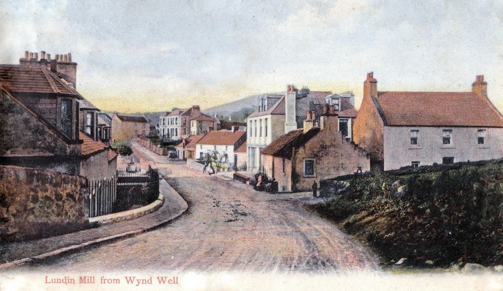
This stretch of Largo Road was for a long time known locally as 'the Wynd' or Well Wynd. The meaning of 'wynd' is a narrow lane or path - sometimes linking places of different heights. It's a perfect description of this stretch of road - being as it is on a slope with higher ground on both sides. The reason why the above postcard is entitled "from Wynd Well" is that there was a well just around the spot where the photographer would have been standing, in at the right hand side of the road. This was a proper well and was in addition to the water pump visible further down the road at the corner of the junction with MIll Wynd. Eventually, the ground to the right, adjacent to the well, was developed and the house built there was aptly named Wellfield. In the next post, a profile of a well known local figure who resided at Wellfield.
|
Wynd Well has been covered in a previous post, with a view similar to this one included. However, the above image is taken from slightly further back and gives a better impression of the roughness of the road, which must have been treacherous when wet and muddy. The steepness of the road was probably even greater further back in time, as it seems likely that the road was raised up to become level with the bridge when it was constructed. Prior to that there would have simply been a ford over the burn. Certainly there are houses on either side of this stretch of road which lie below present road level, suggesting the road is on a man-made embankment.
This stretch of Largo Road was for a long time known locally as 'the Wynd' or Well Wynd. The meaning of 'wynd' is a narrow lane or path - sometimes linking places of different heights. It's a perfect description of this stretch of road - being as it is on a slope with higher ground on both sides. The reason why the above postcard is entitled "from Wynd Well" is that there was a well just around the spot where the photographer would have been standing, in at the right hand side of the road. This was a proper well and was in addition to the water pump visible further down the road at the corner of the junction with MIll Wynd. Eventually, the ground to the right, adjacent to the well, was developed and the house built there was aptly named Wellfield. In the next post, a profile of a well known local figure who resided at Wellfield.
0 Comments
Your comment will be posted after it is approved.
Leave a Reply. |
AboutThis blog is about the history of the villages of Lundin Links, Lower Largo and Upper Largo in Fife, Scotland. Comments and contributions from readers are very welcome!
SearchThere is no in-built search facility on this site. To search for content, go to Google and type your search words followed by "lundin weebly". Categories
All
Archives
July 2024
|

 RSS Feed
