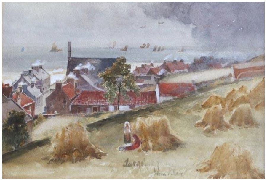
The painting above (entitled 'Harvest in Largo') is a view from what is now Bourtree Terrace/Bourtree Brae, looking over the rooftops of Lower Largo to the south west. Painted around or before 1910 by John Blair, the artist was sitting in what was then a field between the old Durham School and the Main Street. The bellcote of Largo St David's Church dominates the skyline and there are many boats our in the bay.
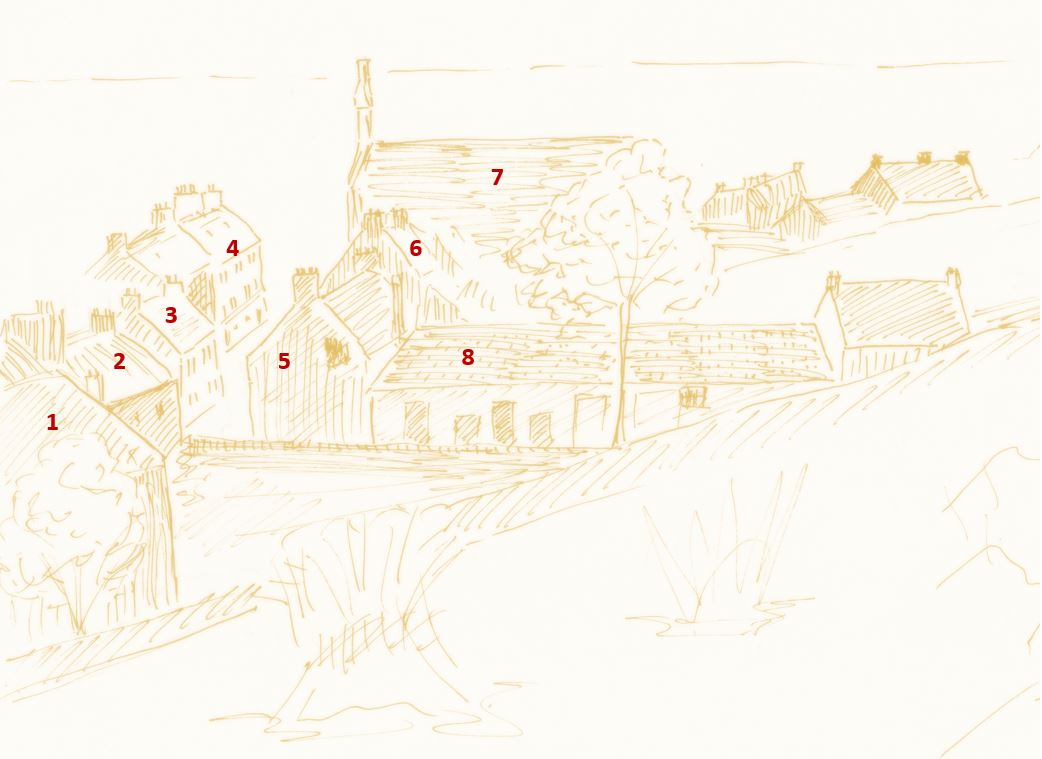
The annotated sketch of the same view highlights the following buildings:
1. Rear of Durham House 2. Goodsir House 3. Balfour Cottage (obscuring Comely Bank to the rear)
4. Grocer and Co-op Shops 5. Court House 6. Downfield
7. Largo St David's Church 8. Doctor's Vennel
Also in the distance to the far right are the long-gone Butter's Buildings.
The 1912 map below helps to clarify where the painting was taken from and the direction of the view. Bourtree Terrace is shown on the map below but is absent from the artwork, showing it was created before the creation of the map. John Blair was a landscape artist born in Berwickshire in 1850, who died in Edinburgh in 1934. At the time of his death the Berwick Advertiser (18 Oct) noted that "his watercolours, well-known to connoisseurs all over the country, depicting often the quaint picturesqueness of fishing villages, met wide appreciation". It's wonderful when an old painting, taken from an unusual position, gives an insight to life in the villages in days gone by.
 RSS Feed
