Note the wide entrance from Drummochy Road right into the harbour, where carts would ford the burn to reach the other side. See also the fishing paraphernalia and the tree stumps and logs lining the pier. At the foot of this post is a zoom-in on the three-storied Drummochy House which has an interesting statue to the right in the garden!
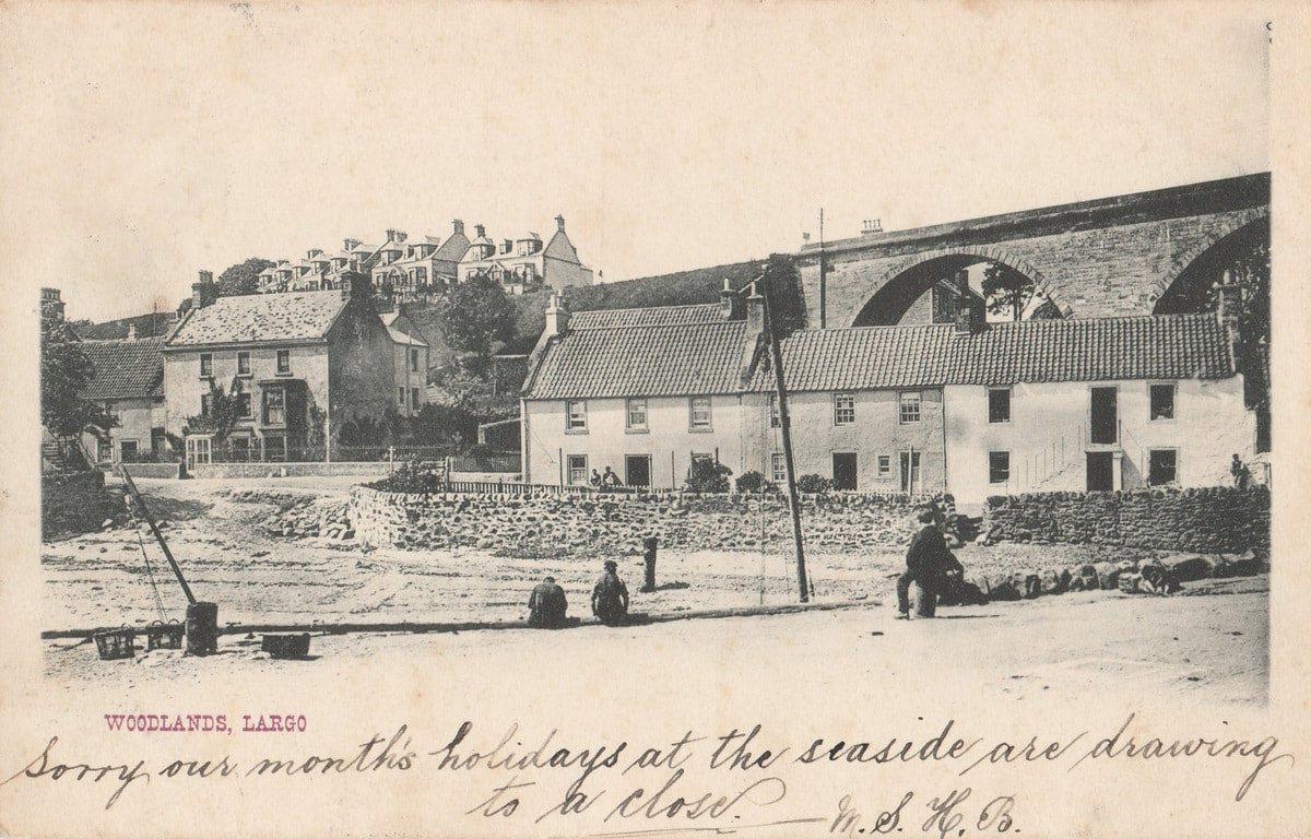
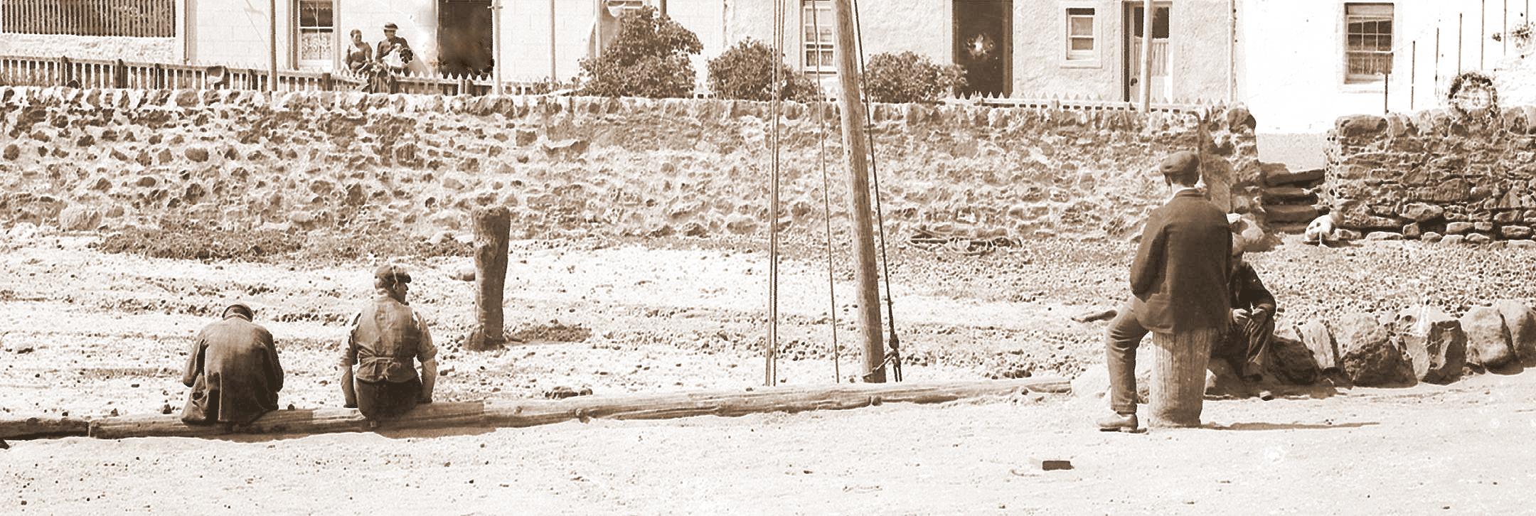
Although the above postcard is entitled "Woodlands, Largo", it is taken from Largo Pier looking over to the houses of Drummochy. The east end of Woodlands Road features in the background left, above the railway line. Posted on 29 August 1903 in Lower Largo, the sender (writing to a friend in Ayrshire) has clearly enjoyed holidaying in Largo. The photograph, taken a few years earlier, is a George Washington Wilson image. When magnified, there is some great detail of people captured as well as other detail of life at the time.
Note the wide entrance from Drummochy Road right into the harbour, where carts would ford the burn to reach the other side. See also the fishing paraphernalia and the tree stumps and logs lining the pier. At the foot of this post is a zoom-in on the three-storied Drummochy House which has an interesting statue to the right in the garden!
4 Comments
John Band
21/8/2018 12:24:28 pm
This postcard picture, pre is a great view of the ford ramp up to the Drummochy side of the harbour, the other end being at the oil mill behind the viaduct. The location of the harbour mooring posts, not only allowed boats to be secured without the ropes obstructing the trackway along the sand but also marked the corners of the ford track. Between each post a low wall of large boulders was built in an effort to maintain the sandy/gravel surface of the ford trackway, some of these can often be seen nearer the viaduct after storms expose them. Many a boat which was moored between the posts has fallen foul of resting on these stones when the tide went out, often leading to split hulls and sinking on the return of the tide. My fathers cabin cruiser was one boat which sank circa 1980 due to resting on these stones after exposure during a storm, a new fibreglass coated marine plywood hull was required!
Reply
John Band
23/8/2018 11:09:21 am
The postcard picture can be dated to between 1892 (when Benjamin Philp, commission agent, Largo built the Burnbrae flats visible through the arch of the viaduct) and 1914 (when the present road bridge was built). Great view of Drummochy House where Benjamin Philp lived and The Mount (the right hand end house on Woodlands Road) where his son Alexander Philp lived and died in 1931, he being the last lessee/operator of the oil mill behind the viaduct
Reply
Alistair Bryden
7/9/2018 07:57:25 am
The stumps on the pier are actually the exposed tops of significant trees or posts that were embedded in the structure of the pier itself. I had always understood that some of he branches were left in place under the surface of the pier to ensure stability and solidity of the posts but I have no evidence for this. The exposed stumps were then used as bollards for securing boats. There were a number in place through the 1970s but I believe that vandals set fires against them.
Reply
John Band
12/9/2018 09:27:52 am
Ye Alistair I remember the pier mooring posts well. As kids we would use them to stand on while dodging waves rolling along the pier. Your right several were burnt out in my day then modern surfacing projects did away with the remainder.
Reply
Your comment will be posted after it is approved.
Leave a Reply. |
AboutThis blog is about the history of the villages of Lundin Links, Lower Largo and Upper Largo in Fife, Scotland. Comments and contributions from readers are very welcome!
SearchThere is no in-built search facility on this site. To search for content, go to Google and type your search words followed by "lundin weebly". Categories
All
Archives
April 2025
|