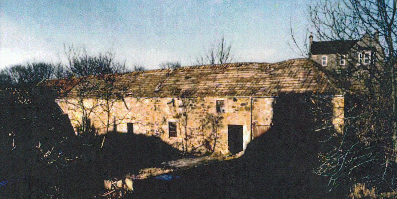
Many will remember the derelict building pictured above which sat on the north side of the Keil Burn at the west side of Largo Road, down in the dip and opposite the former Keilside Bakery. This was demolished in 1995 ahead of the Bett Homes development at Penrice Park. A further development of flats followed a few years later by Thomas Mitchell builders (the later development being more closely aligned to the footprint of the old farm steading). At the time of the demolition (February 1995) archaeological survey work was carried out (just ahead of the digging of drainage and sewage trenches to serve the new housing). Historic Environment Scotland records state that:
"Archaeological watching brief in the course of the demolition programme at the farm steading and mill complex of Lundin Mill Farm, Lundin Links, Fife by GUARD, revealed that the mill with its associated kiln had been the original building on site, followed in the early 19th century by the farm outbuildings. There was no evidence to suggest the existence of earlier buildings at the location, although cartographic evidence indicates that the site was being utilised for milling of grain from at least 1775."
It would seem likely that the building dates to mid-eighteenth century but was renovated in the early nineteenth century around the time that Earnest Cottage was built. Earnest Cottage would appear to have been the farm house before the construction of the newer Lundin Mill Farm House circa 1870s.
John Band has produced a series of drawings to provide an insight to what went on within the building when it was a working mill. To set the scene, please click here to see location maps and some background on 'thirlage' and on water rights. Also, see below for the overall building layout as surveyed in 1995 (source: Glasgow University Archaeological Research Division).
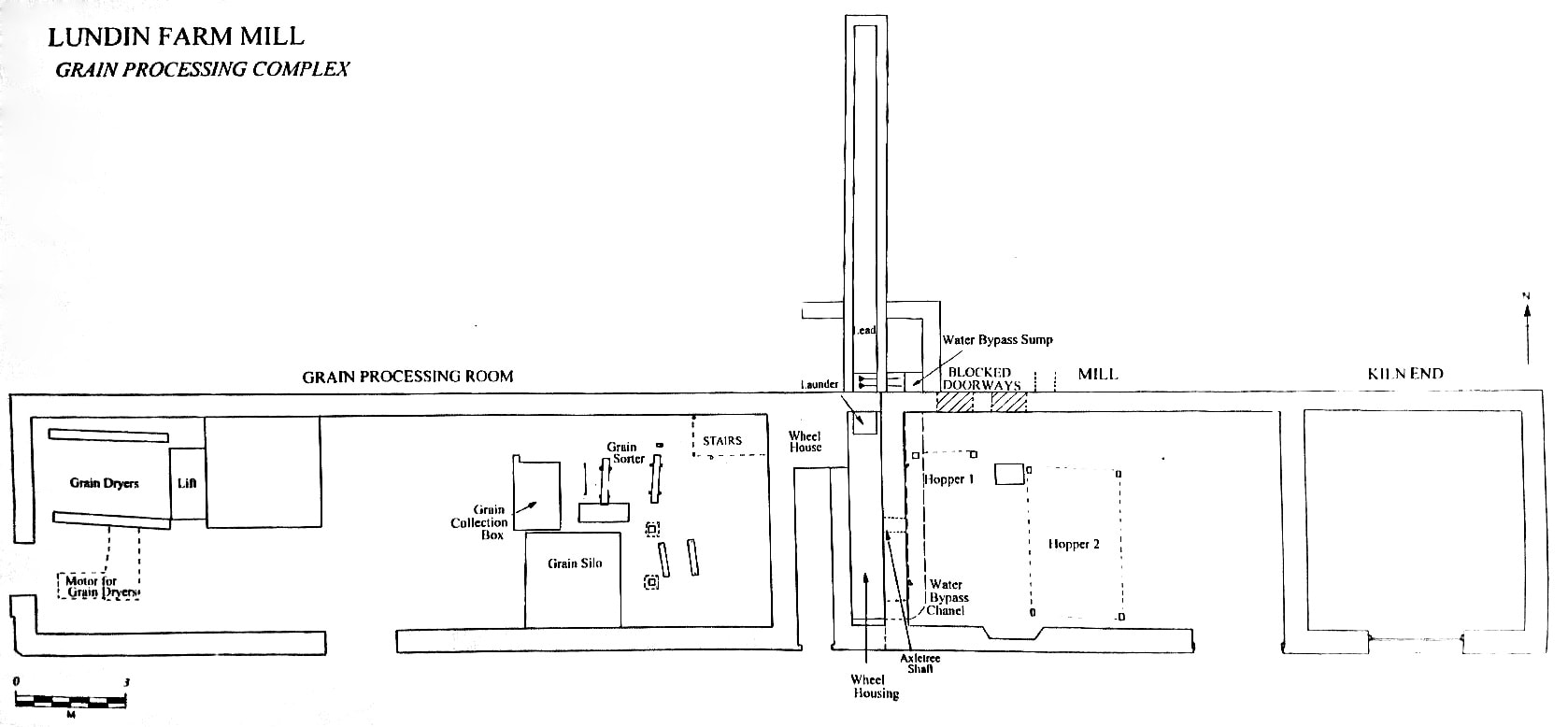
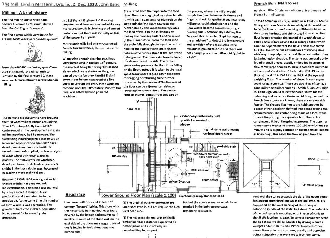
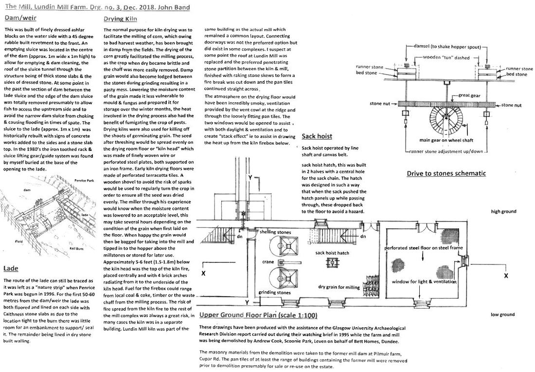
For further context, a brief history of milling is below, along with a floor plan of what was the lower ground floor of the mill end of the building. To view this as a PDF, please click here. Note that the building was constructed by partially cutting into the natural slope of the land, such that access on the south side (closest to the burn) was made at a lower level than on the north side of the building, where access was from the upper floor.
The annotated drawing below, shows the upper ground floor plan of the mill end of the building (immediately above the lower ground floor layout given above). To view that as a PDF please click here.
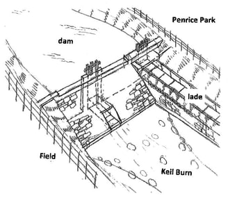
Details are also given below of the dam, weir and lade that served the mill. See inset for larger version of the drawing of the dam across the Keil Burn and the lade that ran alongside.
Details are also given below of the dam, weir and lade that served the mill. See inset for larger version of the drawing of the dam across the Keil Burn and the lade that ran alongside.
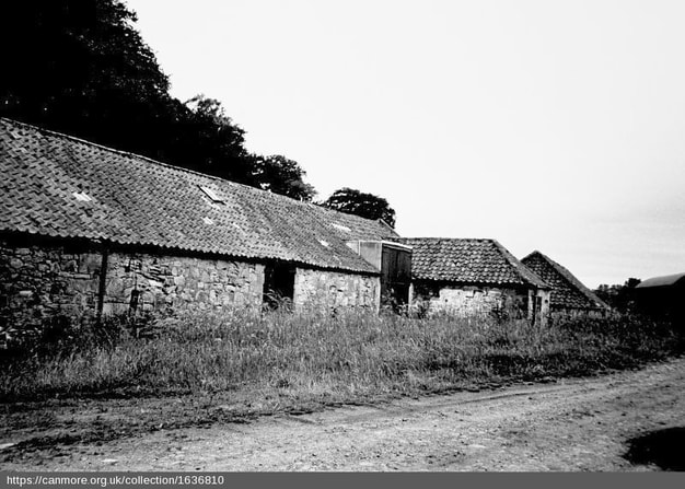
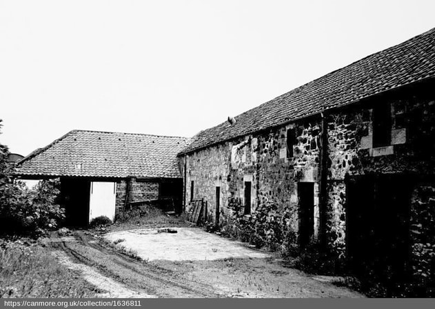
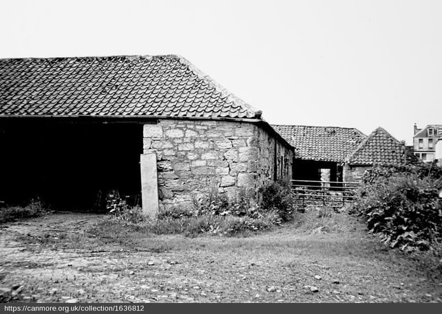
Above are two images from the Canmore collection, showing the building's north elevation (upper photograph) and south elevation (lower photograph). The former having the appearance of a single storey structure while the latter shows two stories.
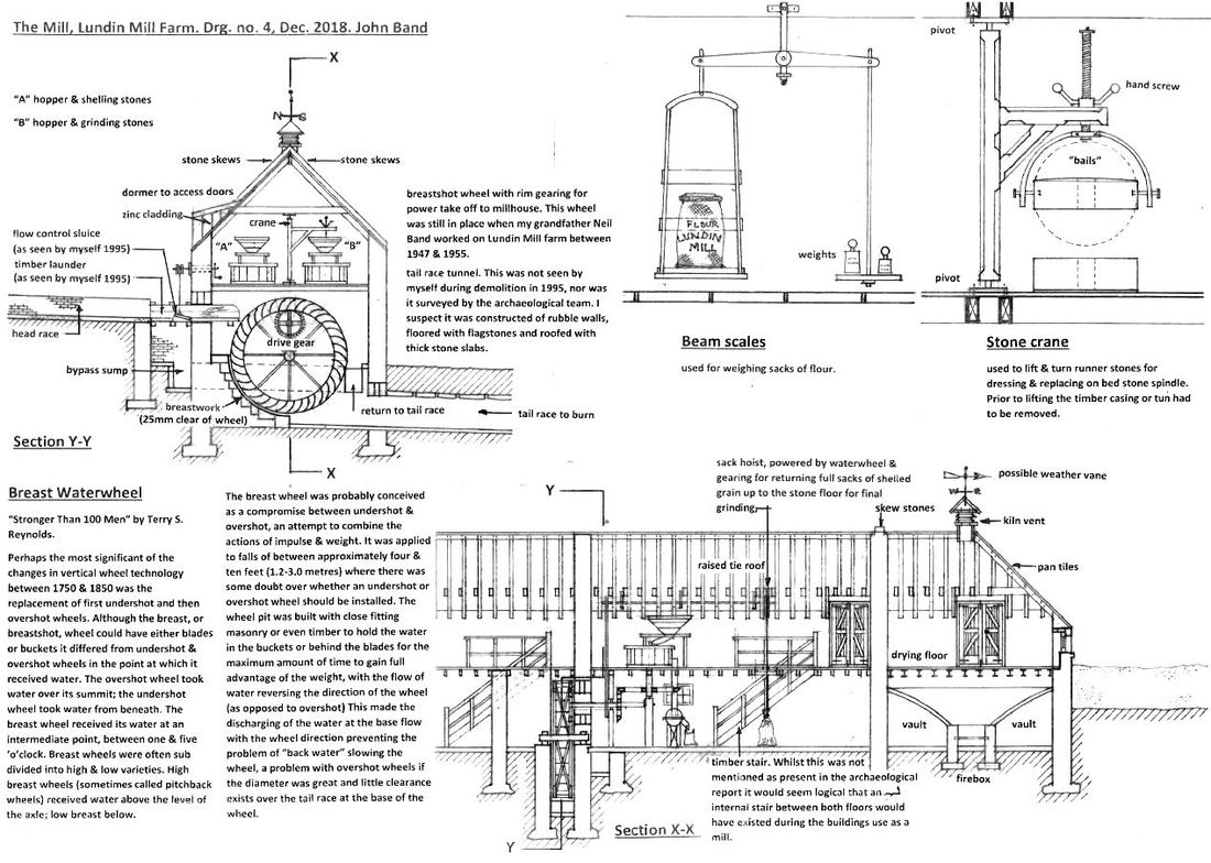
What follows below are section drawings, showing the upper and lower ground floors together and featuring elements such as the waterwheel, hoppers, kiln and hoist. A PDF of this drawing is available here.
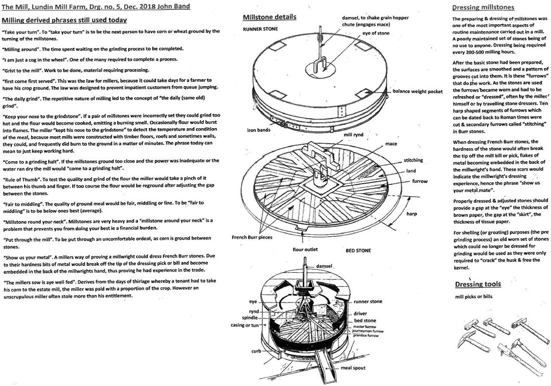
Finally, below are details about millstones and how they were dressed. Also included are a ranged of phrases still used today that derive from the milling process and the days when this was far more central to everyone's daily life. A PDF-version is available here. At the foot of the post is another Canmore photograph - this time showing the west elevation (with the four storey 'Millburnlea' on Largo Road visible on the far right in the distance).
With many thanks to John Band for the detailed research and illustrations.
 RSS Feed
