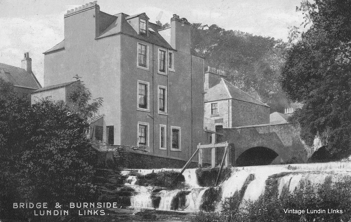
The above circa 1900 postcard image was taken next to the Keil Burn, on the east side of the road bridge on Largo Road (the stretch of road once referred to as The Wynd). The four-storey building on the left is 'Millburnlea', occupied around this time by a shoemaker and a joiner, with shop fronts at street level. Meanwhile on the opposite side of the main road was Bridge House, where Christina Young's newsagent and stationery shop was situated prior to its move to Emsdorf Street.
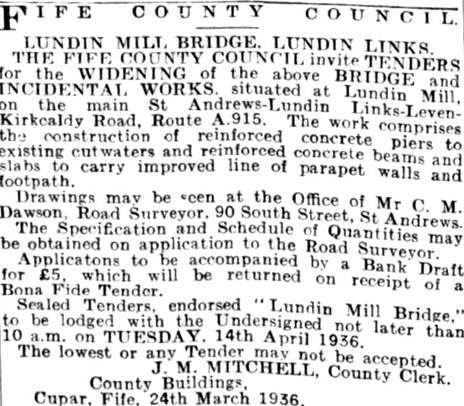
'Burnside' and the sluice gate for the old flour mill have been covered in a previous post. The bridge dates back to the late eighteenth century when the turnpike road system reached Lundin Mill. By the 1930s there were calls for the widening of the narrow and out of date structure. This issue was under consideration for some time, before icy conditions in the winter of 1935/36 led to renewed demands from both residents and visiting motorists. By late March 1936 the advert below had appeared in local paper calling for the submission of tenders to carry out the works.
'Burnside' and the sluice gate for the old flour mill have been covered in a previous post. The bridge dates back to the late eighteenth century when the turnpike road system reached Lundin Mill. By the 1930s there were calls for the widening of the narrow and out of date structure. This issue was under consideration for some time, before icy conditions in the winter of 1935/36 led to renewed demands from both residents and visiting motorists. By late March 1936 the advert below had appeared in local paper calling for the submission of tenders to carry out the works.
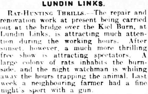
By 27 June, the Fife Free Press reported that "after years of patient waiting, work has at last begun on the much needed scheme of improvement at the narrow bridge at Lundie Mill....for years past this has been a trap to all classes of road users, motorists and pedestrians alike. It is surprising that there have not been more accidents at this spot....One of the most unsatisfactory features was the complete absence of footpaths." This article continued by noting the leading role of Councillor Christopher Gatherum of Upper Largo - who had "pegged away at the question for years". Although ultimately the change was not as significant as had been hoped for, the road was widened by about two feet and a four foot pathway added on the west side. Improvements were complete by late August - but not without incident - as the snippet below from the 4 July Fife Free Press from 1936 illustrates!
 RSS Feed
