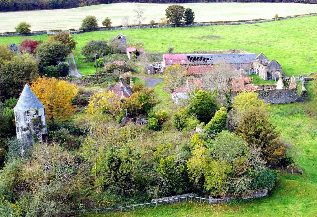
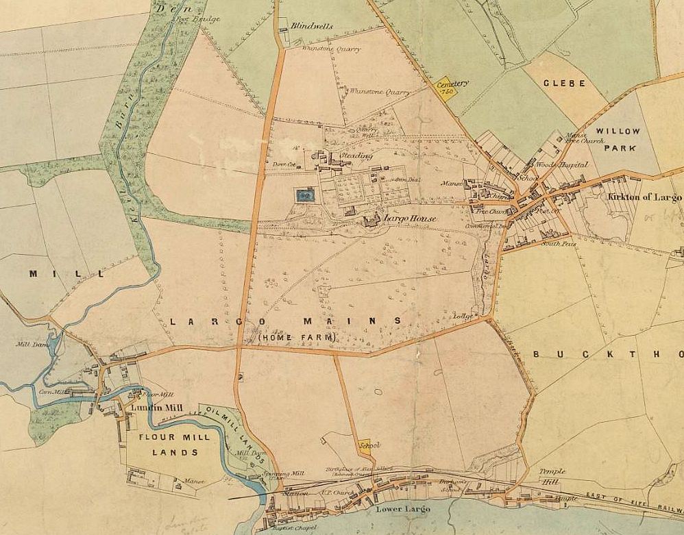
Largo Home Farm was the farm associated with Largo House that now lies in a largely derelict state. Situated to the north west of Largo House, the Home Farm is adjacent to Sir Andrew Wood's Tower (seen to the left in the above aerial photograph). "Home farm" was the widely-used term used for the farm within an estate which provided produce for the estate owner. An estate may have had many farms within its boundaries, most of which would be rented out to tenant farmers. However, the home farm was managed as a source of food and resources for the 'big house'. It was also often where the estate horses were kept. The home farm would be close to the landowner's house, as in this case. The Largo estate owned around a dozen farms, including Lundin Mill, Buckthorns, Chesterstone, Pitcruvie and Bonnyton. The extent of the Home Farm (also referred to as Largo Mains) is shown in the centre of the 1866 map below.
It can be assumed that Largo House has long had farm buildings of some sort to support its occupants. The oldest surviving building is the doocot that stands to the left of the access road to home farm. Doocot is the Scots name for a dovecot or pigeon house. These were used as nesting places for doves or pigeons and could contain hundreds of nesting boxes or ‘pigeon holes’. The birds were an important source of fresh meat in the days when it was a challenge to keep livestock over the winter. Their feathers and droppings were also utilised for pillows and fertiliser, respectively. Read more about Fife's doocots here.
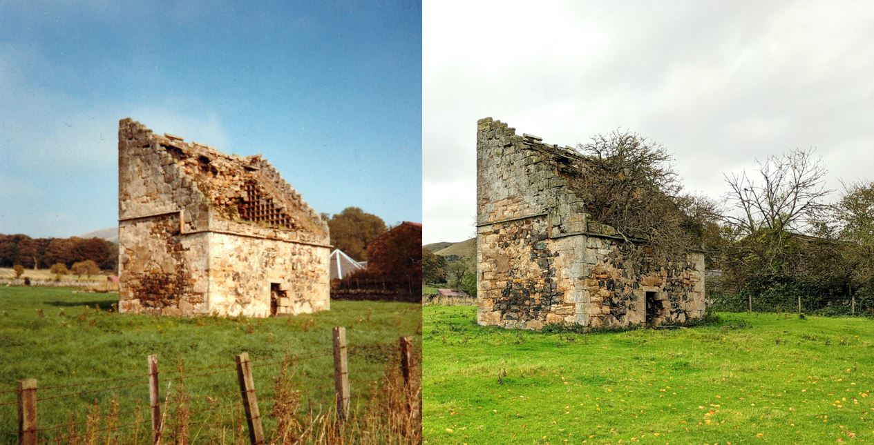
The Largo Home Farm Doocot dates to the late 17th century and, like many others in Fife, is of the 'lectern' style. Note the south facing mono-pitched roof (now collapsed), the crow-stepped gables (where pigeons could perch) and the 'rat course' external ledge to prevent rats climbing the walls to access to doocot to steal eggs. The condition of the doocot has deteriorated noticeably over the last few decades. Below are a pair of photos taken from the same spot - on the left is a 1989 view and on the right an image captured in 2020. In thirty years, vegetation has taken hold within the roofless structure (much like what has happened to Largo House itself). The 1989 photo also shows the roof of the horse mill in the background to the right of the doocot. The horse mill structure has now collapsed (more on that later).
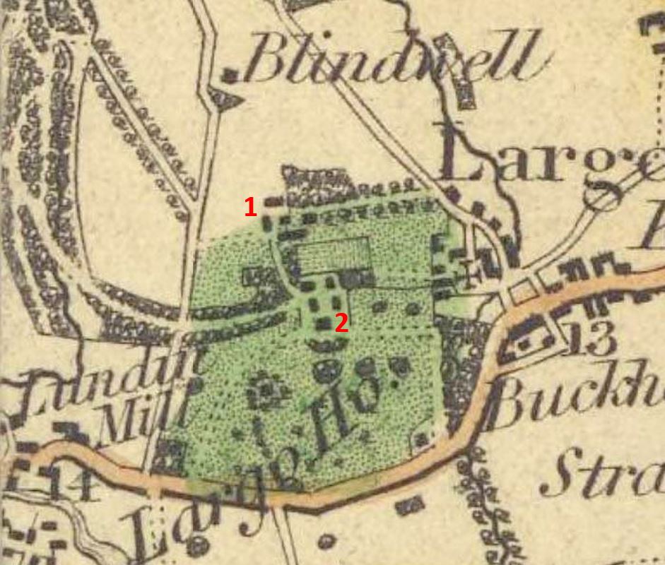
The other main buildings of the home farm are of a lesser age than the doocot. The 1775 Ainslie map of Fife shows Largo House and Wood's Tower but no evidence of the Home Farm buildings. This could, however, be due to a lack of detail on that particular map. The 1826 Greenwood map does clearly show the farm buildings. An extract from this is below, showing the Home Farm (1) in roughly the same layout as today, as well as Largo House and the buildings that surround it (2), including the 1815 stable block.
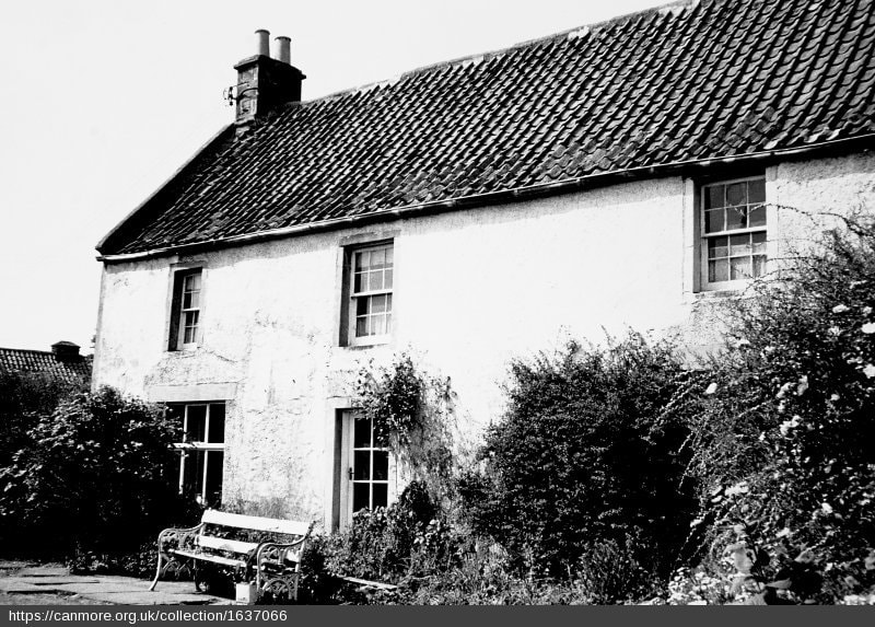
Canmore describes the listed Farmhouse at Largo Home Farm (pictured below as it was in 1975) as 18th century with the following description:
"2 storey, 3 bay house, harled with painted ashlar dressings. Glazed central door and enlarged windows to ground floor. Original first floor glazing. Pantiled roof, straight skews with simply moulded skew putts to front and crowsteps to rear at north east gable. End stacks. Single storey wing to right, rubble with droved ashlar dressings and pantile roof. Modern addition at rear."
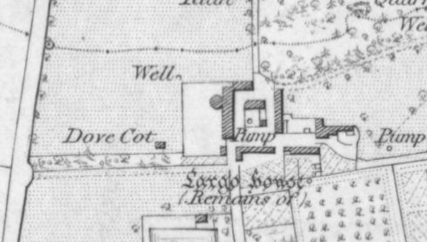
The farmhouse is located on the far right of the home farm group of buildings (see 1854 O.S. map further below), which also include a distinctive horseshoe-shaped byre, a row of farm cottages, a horse mill and other steading buildings. In part two - a photo tour of these buildings with further description of how they were once used.
 RSS Feed
